|
search place name
|
||
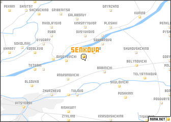
Senʼkova (Belarus)Senʼkova is a town in Belarus. An overview map of the region around Senʼkova is displayed below.
regional and 3d topo map of Senʼkova, Belarus ::
Senʼkova airports ::
The nearest airport is VTB - Vitebsk, located 17.6 km south of Senʼkova.
Nearby towns ::
Gralëva (2.1km north east) //
Avdeyevichi (2.4km west) //
Babinichi (3.4km south east) //
Sakharova (4.3km north east) //
Ovsyukovo (5.6km north) //
Andronovichi (4.6km south west) //
Lushchikha (5.9km north) //
Verkhovʼye (4.1km west) //
Krasnyy Dvor (7.4km north) //
Tulovo (7.5km south) //
Sebyakhi (7.7km south) //
Skulovichi (7.0km south east) //
Ruba (7.0km north west) //
Pleshki (8.1km north east) //
Zhurzhëvo (8.5km south west) //
Nikolayevo (8.5km north west) //
Pushkari (9.4km south east) //
[all distances 'as the bird flies' and approximate]  Places with similar names to Senʼkova, Belarus ::
Disclaimer :: Information on this page comes without warranty of any kind |
||
|
Where is Senʼkova? Elevation and coordinates ::
Latitude (lat): 55°17'0"N Longitude (lon): 30°19'0"E
Elevation (approx.): 170m (map arrows pan, magnifying glasses zoom) |
||
|
Visiting Senʼkova? Hotel/Accommodation ::
Book a hotel in Senʼkova Travel Guide ::
Buy a travel guide for Belarus rental cars ::
car rental offers GPS waypoint ::
download a GPX waypoint (PoI) of Senʼkova for your GPS receiver
|
||