|
search place name
|
||
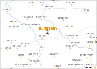
Slasteny (Mahilyowskaya Voblastsʼ, Belarus)Slasteny is a town in the Mahilyowskaya Voblastsʼ region of Belarus. An overview map of the region around Slasteny is displayed below.
regional and 3d topo map of Slasteny, Belarus ::
Slasteny airports ::
The nearest airport is VTB - Vitebsk, located 128.8 km north of Slasteny.
Other airports nearby include GME - Gomel (164.3 km south), Nearby towns ::
Poplavy (2.0km south west) //
Ryki (6.0km south) //
Zhdanovichi (6.2km north) //
Bolʼshoye Bushkovo (5.0km north west) //
Korovchino (6.4km north east) //
Zarestʼye (5.2km north west) //
Shestaki (5.3km north east) //
Pridantsy (8.7km south) //
Bardzily (7.2km south east) //
Yasʼkovichi (7.6km north west) //
Ivanovichi (9.1km south) //
[all distances 'as the bird flies' and approximate] 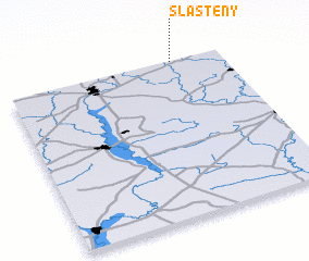 Places with similar names to Slasteny, Belarus ::
// Celestino (PH)
// Celestine (US)
// Selsten (DE)
// Celestynów (PL)
// Celestynów (PL)
// Celestynów (PL)
// Celestynów (PL)
// Celestyny (PL)
// Săliştea Nouă (RO)
// Selişteni (RO)
Disclaimer :: Information on this page comes without warranty of any kind |
||
|
Where is Slasteny? Elevation and coordinates ::
Latitude (lat): 53°59'46"N Longitude (lon): 30°46'19"E
Elevation (approx.): 180m (map arrows pan, magnifying glasses zoom) |
||
|
Visiting Slasteny? Hotel/Accommodation ::
Book a hotel in Slasteny Travel Guide ::
Buy a travel guide for Belarus rental cars ::
car rental offers GPS waypoint ::
download a GPX waypoint (PoI) of Slasteny for your GPS receiver
|
||