|
search place name
|
||
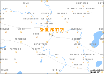
Smolyantsy (Belarus)Smolyantsy is a town in Belarus. An overview map of the region around Smolyantsy is displayed below.
regional and 3d topo map of Smolyantsy, Belarus ::
Smolyantsy airports ::
The nearest airport is VTB - Vitebsk, located 81.5 km north east of Smolyantsy.
Other airports nearby include MSQ - Minsk 2 (129.7 km south west), MHP - Minsk 1 (151.8 km south west), Nearby towns ::
Pridvorʼye (2.1km south west) //
Krasnaya Zvezda (2.1km north east) //
Oktyabrʼskiy (3.9km north) //
Olʼshanka (2.8km north east) //
Chashniki (3.3km north west) //
Pochayevichi (4.3km south west) //
Varki (3.2km west) //
Koptevichi (5.7km north) //
Olʼshanka Malaya (3.7km north east) //
Lyski (7.5km south) //
Kozanovka (7.5km north) //
Lutik (6.4km north east) //
Slidets (6.4km south west) //
Zakurʼye (7.7km south) //
Pechevka (7.7km north) //
Brazdetskaya (7.0km north west) //
Pristoi (8.6km north west) //
[all distances 'as the bird flies' and approximate]  Places with similar names to Smolyantsy, Belarus ::
// Smolyanitsa (BY)
// Smolyantsy (BY)
Disclaimer :: Information on this page comes without warranty of any kind |
||
|
Where is Smolyantsy? Elevation and coordinates ::
Latitude (lat): 54°50'0"N Longitude (lon): 29°11'0"E
Elevation (approx.): 127m (map arrows pan, magnifying glasses zoom) |
||
|
Visiting Smolyantsy? Hotel/Accommodation ::
Book a hotel in Smolyantsy Travel Guide ::
Buy a travel guide for Belarus rental cars ::
car rental offers GPS waypoint ::
download a GPX waypoint (PoI) of Smolyantsy for your GPS receiver
|
||