|
search place name
|
||
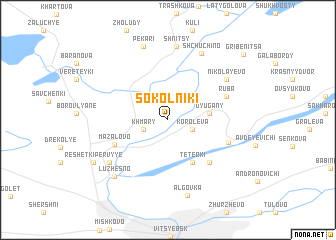
Sokolʼniki (Vitsyebskaya Voblastsʼ, Belarus)Sokolʼniki is a town in the Vitsyebskaya Voblastsʼ region of Belarus. An overview map of the region around Sokolʼniki is displayed below.
regional and 3d topo map of Sokolʼniki, Belarus ::
Sokolʼniki airports ::
The nearest airport is VTB - Vitebsk, located 22.7 km south east of Sokolʼniki.
Nearby towns ::
Khmary (1.9km south west) //
Korolëva (1.9km south east) //
Dyugany (2.7km east) //
Tetërki (5.0km south) //
Mazalovo (4.4km south west) //
Kashino (5.5km south east) //
Ruba (4.5km north east) //
Verkhovʼye (4.6km south east) //
Nikolayevo (5.8km north east) //
Mikheyeva (6.0km south west) //
Shnitsy (8.2km north) //
Shchuchino (7.7km north) //
Pekari (8.3km north) //
Alʼgovka (8.5km south) //
Luzhesno (7.2km south west) //
Reshëtki Pervyye (6.7km south west) //
Gribenitsa (8.8km north east) //
[all distances 'as the bird flies' and approximate] 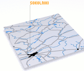 Places with similar names to Sokolʼniki, Belarus ::
// Schölling (AT)
// Schilling (US)
// Schelleneck (DE)
// Schellneck (DE)
// Schlankau (DE)
// Schöllang (DE)
// Schölling (DE)
// Sickling (DE)
// Sickling (DE)
// Skouliánika (GR)
Disclaimer :: Information on this page comes without warranty of any kind |
||
|
Where is Sokolʼniki? Elevation and coordinates ::
Latitude (lat): 55°18'35"N Longitude (lon): 30°11'30"E
Elevation (approx.): 169m (map arrows pan, magnifying glasses zoom) |
||
|
Visiting Sokolʼniki? Hotel/Accommodation ::
Book a hotel in Sokolʼniki Travel Guide ::
Buy a travel guide for Belarus rental cars ::
car rental offers GPS waypoint ::
download a GPX waypoint (PoI) of Sokolʼniki for your GPS receiver
|
||