|
search place name
|
||
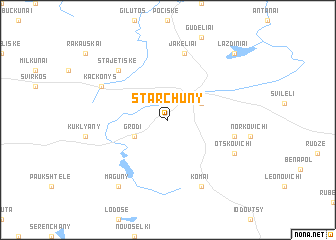
Starchuny (Belarus)Starchuny is a town in Belarus. An overview map of the region around Starchuny is displayed below.
regional and 3d topo map of Starchuny, Belarus ::
Starchuny airports ::
The nearest airport is MHP - Minsk 1, located 154.7 km south east of Starchuny.
Other airports nearby include MSQ - Minsk 2 (168.5 km south east), Nearby towns ::
Adutiškis (2.8km north east) //
Grodi (2.8km south west) //
Muntsevichi (4.6km south east) //
Jakeliai (7.5km north) //
Stajetiškė (6.4km north west) //
Komai (7.7km south) //
Otskovichi (5.6km south east) //
Kackonys (5.6km north west) //
Maguny (8.1km south west) //
Lazdiniai (8.5km north east) //
[all distances 'as the bird flies' and approximate]  Places with similar names to Starchuny, Belarus ::
// Starshino (RU)
// Strashnyye (RU)
// Strechno (RU)
// Zaterechnyy (RU)
// Strechen (AT)
// Streichen (DE)
// Stroúsion (GR)
// Strachanów (PL)
// Stareyshino (BG)
// Starichene (BG)
Disclaimer :: Information on this page comes without warranty of any kind |
||
|
Where is Starchuny? Elevation and coordinates ::
Latitude (lat): 55°8'0"N Longitude (lon): 26°34'0"E
Elevation (approx.): 169m (map arrows pan, magnifying glasses zoom) |
||
|
Visiting Starchuny? Hotel/Accommodation ::
Book a hotel in Starchuny Travel Guide ::
Buy a travel guide for Belarus rental cars ::
car rental offers GPS waypoint ::
download a GPX waypoint (PoI) of Starchuny for your GPS receiver
|
||