|
search place name
|
||
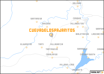
Cueva de los Pajaritos (Córdoba, Argentina)Cueva de los Pajaritos is a town in the Córdoba region of Argentina. An overview map of the region around Cueva de los Pajaritos is displayed below.
regional and 3d topo map of Cueva de los Pajaritos, Argentina ::
Cueva de los Pajaritos airports ::
The nearest airport is COR - Cordoba Ambrosio L V Taravella, located 34.2 km east of Cueva de los Pajaritos.
Other airports nearby include VDR - Villa Dolores (90.2 km south west), RCU - Rio Cuarto Area De Material (200.0 km south), LUQ - San Luis (276.2 km south west), Nearby towns ::
San José (4.0km north west) //
Villa García (4.0km south east) //
Tanti (4.9km south west) //
Tanti Nuevo (5.6km south) //
Cavalango (7.4km south) //
Santa Rosa (7.3km north west) //
[all distances 'as the bird flies' and approximate] 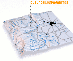 Places with similar names to Cueva de los Pajaritos, Argentina :: Disclaimer :: Information on this page comes without warranty of any kind |
||
|
Where is Cueva de los Pajaritos? Elevation and coordinates ::
Latitude (lat): 31°18'0"S Longitude (lon): 64°34'0"W
Elevation (approx.): 940m (map arrows pan, magnifying glasses zoom) |
||
|
Visiting Cueva de los Pajaritos? Hotel/Accommodation ::
Book a hotel in Cueva de los Pajaritos Travel Guide ::
Buy a travel guide for Argentina rental cars ::
car rental offers GPS waypoint ::
download a GPX waypoint (PoI) of Cueva de los Pajaritos for your GPS receiver
|
||