|
search place name
|
||
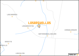
Los Argüellos (San Luis, Argentina)Los Argüellos is a town in the San Luis region of Argentina. An overview map of the region around Los Argüellos is displayed below.
regional and 3d topo map of Los Argüellos, Argentina ::
Los Argüellos airports ::
The nearest airport is VDR - Villa Dolores, located 40.2 km north of Los Argüellos.
Other airports nearby include RCU - Rio Cuarto Area De Material (126.1 km south east), COR - Cordoba Ambrosio L V Taravella (145.4 km north east), LUQ - San Luis (150.7 km south west), Nearby towns ::
Santa Rosa del Conlara (4.9km south east) //
Los Duraznitos (4.7km west) //
[all distances 'as the bird flies' and approximate] 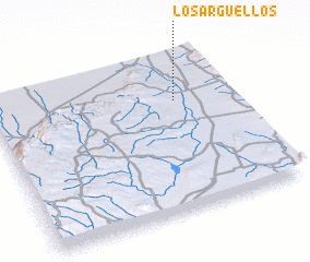 Places with similar names to Los Argüellos, Argentina ::
Disclaimer :: Information on this page comes without warranty of any kind |
||
|
Where is Los Argüellos? Elevation and coordinates ::
Latitude (lat): 32°18'0"S Longitude (lon): 65°14'0"W
Elevation (approx.): 585m (map arrows pan, magnifying glasses zoom) |
||
|
Visiting Los Argüellos? Hotel/Accommodation ::
Book a hotel in Los Argüellos Travel Guide ::
Buy a travel guide for Argentina rental cars ::
car rental offers GPS waypoint ::
download a GPX waypoint (PoI) of Los Argüellos for your GPS receiver
|
||