|
search place name
|
||
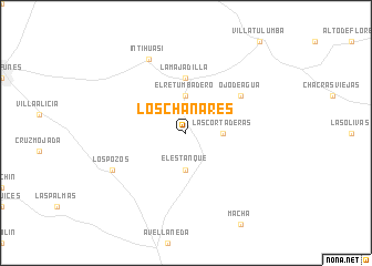
Los Chañares (Córdoba, Argentina)Los Chañares is a town in the Córdoba region of Argentina. An overview map of the region around Los Chañares is displayed below.
regional and 3d topo map of Los Chañares, Argentina ::
Los Chañares airports ::
The nearest airport is COR - Cordoba Ambrosio L V Taravella, located 93.2 km south of Los Chañares.
Other airports nearby include VDR - Villa Dolores (186.2 km south west), CTC - Catamarca (258.8 km north west), Nearby towns ::
Las Cortaderas (3.2km east) //
El Retumbadero (3.7km north) //
El Estanque (3.7km south) //
La Majadilla (5.6km north) //
Ojo de Agua (6.1km north east) //
Inti Huasi (8.1km north west) //
Los Pozos (7.4km south west) //
[all distances 'as the bird flies' and approximate] 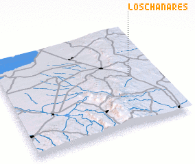 Places with similar names to Los Chañares, Argentina ::
// Las Canarias (CO)
// Los Chañares (AR)
// Los Chañares (AR)
// Les Coniers (FR)
// Les Sagnères (FR)
Disclaimer :: Information on this page comes without warranty of any kind |
||
|
Where is Los Chañares? Elevation and coordinates ::
Latitude (lat): 30°29'0"S Longitude (lon): 64°11'0"W
Elevation (approx.): 748m (map arrows pan, magnifying glasses zoom) |
||
|
Visiting Los Chañares? Hotel/Accommodation ::
Book a hotel in Los Chañares Travel Guide ::
Buy a travel guide for Argentina rental cars ::
car rental offers GPS waypoint ::
download a GPX waypoint (PoI) of Los Chañares for your GPS receiver
|
||