|
search place name
|
||
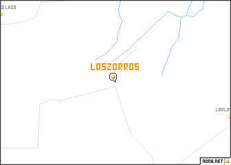
Los Zorros (Córdoba, Argentina)Los Zorros is a town in the Córdoba region of Argentina. An overview map of the region around Los Zorros is displayed below.
regional and 3d topo map of Los Zorros, Argentina ::
Los Zorros airports ::
The nearest airport is COR - Cordoba Ambrosio L V Taravella, located 125.0 km north west of Los Zorros.
Other airports nearby include RCU - Rio Cuarto Area De Material (152.0 km south west), VDR - Villa Dolores (184.3 km west), Nearby towns ::
[all distances 'as the bird flies' and approximate]  Places with similar names to Los Zorros, Argentina ::
// Los Zorros (VE)
// Las Zorras (PE)
// Les Issers (DZ)
// Les Ozaras (DZ)
// Los Osorios (DO)
// Les Zéros (FR)
Disclaimer :: Information on this page comes without warranty of any kind |
||
|
Where is Los Zorros? Elevation and coordinates ::
Latitude (lat): 32°3'0"S Longitude (lon): 63°12'0"W
Elevation (approx.): 196m (map arrows pan, magnifying glasses zoom) |
||
|
Visiting Los Zorros? Hotel/Accommodation ::
Book a hotel in Los Zorros Travel Guide ::
Buy a travel guide for Argentina rental cars ::
car rental offers GPS waypoint ::
download a GPX waypoint (PoI) of Los Zorros for your GPS receiver
|
||