|
search place name
|
||
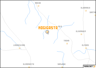
Mogigasta (Córdoba, Argentina)Mogigasta is a town in the Córdoba region of Argentina. An overview map of the region around Mogigasta is displayed below.
regional and 3d topo map of Mogigasta, Argentina ::
Mogigasta airports ::
The nearest airport is VDR - Villa Dolores, located 41.0 km south of Mogigasta.
Other airports nearby include COR - Cordoba Ambrosio L V Taravella (101.6 km east), RCU - Rio Cuarto Area De Material (190.0 km south east), LUQ - San Luis (215.1 km south west), Nearby towns ::
 Places with similar names to Mogigasta, Argentina ::
// Magic City (US)
// Magic City (US)
Disclaimer :: Information on this page comes without warranty of any kind |
||
|
Where is Mogigasta? Elevation and coordinates ::
Latitude (lat): 31°35'0"S Longitude (lon): 65°14'0"W
Elevation (approx.): 1140m (map arrows pan, magnifying glasses zoom) |
||
|
Visiting Mogigasta? Hotel/Accommodation ::
Book a hotel in Mogigasta Travel Guide ::
Buy a travel guide for Argentina rental cars ::
car rental offers GPS waypoint ::
download a GPX waypoint (PoI) of Mogigasta for your GPS receiver
|
||