|
search place name
|
||
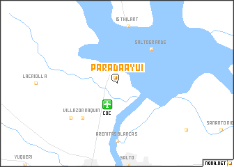
Parada Ayuí (Corrientes, Argentina)Parada Ayuí is a town in the Corrientes region of Argentina. An overview map of the region around Parada Ayuí is displayed below.
regional and 3d topo map of Parada Ayuí, Argentina ::
Parada Ayuí airports ::
The nearest airport is COC - Concordia Comodoro Pierrestegui, located 3.6 km south of Parada Ayuí.
Other airports nearby include STY - Salto Nueva Hesperides Intl (19.1 km south), URG - Uruguaiana Rubem Berta (187.9 km north east), AOL - Paso De Los Libres (192.2 km north east), GHU - Gualeguaychu (202.3 km south), Nearby towns ::
Salto Grande (7.3km north east) //
Villa Zorraquín (7.3km south west) //
Osvaldo Magnasco (8.4km south west) //
[all distances 'as the bird flies' and approximate] 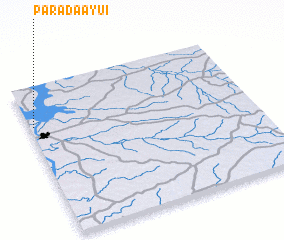 Places with similar names to Parada Ayuí, Argentina :: Disclaimer :: Information on this page comes without warranty of any kind |
||
|
Where is Parada Ayuí? Elevation and coordinates ::
Latitude (lat): 31°16'0"S Longitude (lon): 57°59'0"W
Elevation (approx.): 51m (map arrows pan, magnifying glasses zoom) |
||
|
Visiting Parada Ayuí? Hotel/Accommodation ::
Book a hotel in Parada Ayuí Travel Guide ::
Buy a travel guide for Argentina rental cars ::
car rental offers GPS waypoint ::
download a GPX waypoint (PoI) of Parada Ayuí for your GPS receiver
|
||