|
search place name
|
||
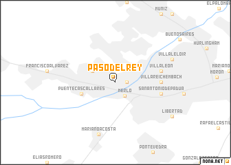
Paso del Rey (Buenos Aires, Argentina)Paso del Rey is a town in the Buenos Aires region of Argentina. An overview map of the region around Paso del Rey is displayed below.
regional and 3d topo map of Paso del Rey, Argentina ::
Paso del Rey airports ::
The nearest airport is AEP - Buenos Aires Aeroparque Jorge Newbery, located 33.7 km east of Paso del Rey.
Other airports nearby include LPG - La Plata (87.4 km south east), GHU - Gualeguaychu (182.4 km north), Nearby towns ::
Villa Sanguinetti (1.5km east) //
Merlo (2.6km south east) //
La Reja (3.6km north west) //
Puente Cascallares (4.9km west) //
Villa Reichembach (6.1km east) //
Villa León (6.4km east) //
San Antonio de Padua (6.4km east) //
Mariano Acosta (8.7km south) //
[all distances 'as the bird flies' and approximate] 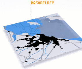 Places with similar names to Paso del Rey, Argentina ::
// Pasteleiro (PT)
// Pusatlar (TR)
// Paso de Lora (CO)
// Paso del Río (SV)
// Paso del Río (MX)
// Paso del Río (MX)
// Pastelera (MX)
// Paso del Río (VE)
// Paso del Rey (AR)
Disclaimer :: Information on this page comes without warranty of any kind |
||
|
Where is Paso del Rey? Elevation and coordinates ::
Latitude (lat): 34°39'0"S Longitude (lon): 58°46'0"W
Elevation (approx.): 20m (map arrows pan, magnifying glasses zoom) |
||
|
Visiting Paso del Rey? Hotel/Accommodation ::
Book a hotel in Paso del Rey Travel Guide ::
Buy a travel guide for Argentina rental cars ::
car rental offers GPS waypoint ::
download a GPX waypoint (PoI) of Paso del Rey for your GPS receiver
|
||