|
search place name
|
||
Villa Nougues (Tucumán, Argentina)Villa Nougues is a town in the Tucumán region of Argentina. An overview map of the region around Villa Nougues is displayed below.
regional and 3d topo map of Villa Nougues, Argentina ::

Villa Nougues airports ::
The nearest airport is TUC - Tucuman Teniente Benjamin Matienzo, located 27.7 km east of Villa Nougues.
Other airports nearby include SDE - Santiago Del Estero (146.9 km south east), CTC - Catamarca (196.5 km south), SLA - Salta (221.1 km north), Nearby towns ::
Mundo Nuevo (3.8km south east) //
Ciudad Hospital Parque Aconquija (6.5km north east) //
La Rinconada (6.6km east) //
San Javier (7.4km north) //
San Pablo (6.9km east) //
Yerba Buena (7.6km north east) //
Ciudad Universitaria (8.1km north east) //
Ingenio San Pablo (8.6km south east) //
Potrero de las Tablas (8.6km south west) //
Ingenio Lules (8.9km south east) //
[all distances 'as the bird flies' and approximate] 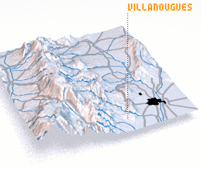 Places with similar names to Villa Nougues, Argentina ::
// Vlóngos (GR)
// Vallongas (ES)
// Phalanx (US)
// Phalanx (US)
// Flangas (US)
// Filincas (GT)
// Foulangues (FR)
// Villenauxe (FR)
Disclaimer :: Information on this page comes without warranty of any kind |
||
|
Where is Villa Nougues? Elevation and coordinates ::
Latitude (lat): 26°51'0"S Longitude (lon): 65°23'0"W
Elevation (approx.): 1412m (map arrows pan, magnifying glasses zoom) |
||
|
Visiting Villa Nougues? Hotel/Accommodation ::
Book a hotel in Villa Nougues Travel Guide ::
Buy a travel guide for Argentina rental cars ::
car rental offers GPS waypoint ::
download a GPX waypoint (PoI) of Villa Nougues for your GPS receiver
|
||