|
search place name
|
||
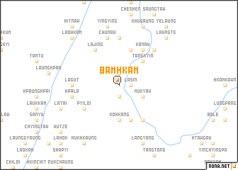
Bamhkam (Kachin State, Myanmar)Bamhkam is a town in the Kachin State region of Myanmar. An overview map of the region around Bamhkam is displayed below.
regional and 3d topo map of Bamhkam, Myanmar ::
Bamhkam airports ::
The nearest airport is MYT - Myitkyina, located 116.7 km south west of Bamhkam.
Other airports nearby include PBU - Putao (166.2 km north west), Nearby towns ::
Lasin (1.7km east) //
Ngamaw (1.9km south) //
Mangpyaw (1.9km north) //
Mukyaw (3.8km south east) //
Tangkyin (5.0km north east) //
Ko-hkang (5.6km south) //
Yindam (5.8km south) //
Myawchawng (5.8km north) //
Ngawlawngtam (6.5km south east) //
Pyiloi (6.2km south west) //
Kanaw (6.5km north east) //
Lajing (6.5km north west) //
Lagut (6.7km west) //
Rithtaung (7.4km north) //
Hpāla (6.9km west) //
Chunaw (7.6km north) //
Wawhtung (7.5km north east) //
Lawngte (10.0km north east) //
Laohkam (10.0km north west) //
[all distances 'as the bird flies' and approximate] 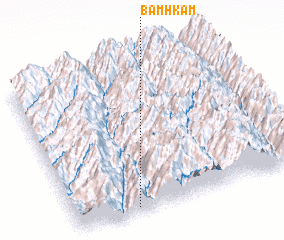 Places with similar names to Bamhkam, Myanmar ::
// Bamougoum (CM)
// Bamougoum II (CM)
// Bemakamba (MG)
// Bemakamba (MG)
// Bemakamba (MG)
// Bemakamba (MG)
// Bemakamba (MG)
// Bemikimbo (MG)
// Bomo Komo I (GA)
// Bomo Komo II (GA)
Disclaimer :: Information on this page comes without warranty of any kind |
||
|
Where is Bamhkam? Elevation and coordinates ::
Latitude (lat): 26°2'0"N Longitude (lon): 98°16'0"E
Elevation (approx.): 926m (map arrows pan, magnifying glasses zoom) |
||
|
Visiting Bamhkam? Hotel/Accommodation ::
Book a hotel in Bamhkam Travel Guide ::
Buy a travel guide for Myanmar rental cars ::
car rental offers GPS waypoint ::
download a GPX waypoint (PoI) of Bamhkam for your GPS receiver
|
||