|
search place name
|
||
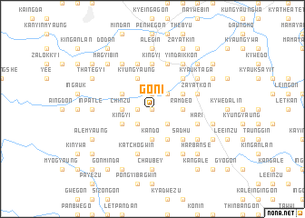
Goni (Myanmar)Goni is a town in Myanmar. An overview map of the region around Goni is displayed below.
regional and 3d topo map of Goni, Myanmar ::
Goni airports ::
The nearest airport is RGN - Yangon Intl, located 143.3 km south of Goni.
Nearby towns ::
Gondwa (0.0km north) //
Hmandan (1.9km north) //
Mahngu (1.8km west) //
Hanumān (2.6km south east) //
Sheo Ghulam (2.6km south east) //
Okshitkon (2.6km south west) //
Kinthagin (2.6km south west) //
Girah (2.6km north east) //
Gopalganj (2.6km north east) //
Rām Deo (3.5km east) //
Kāndo (3.7km south) //
Chinzu (3.5km west) //
Cheru (4.1km south east) //
Hari Charan (4.0km north east) //
Gonmingwin (4.0km south west) //
Kingyi (4.0km south west) //
Kyungyaung (4.1km north west) //
Thategyi Ywathit (4.0km north west) //
Sādhu (5.1km south east) //
Mengu (5.1km north east) //
Kingyi (5.6km north) //
Ratanpur (5.6km east) //
Hari (5.6km east) //
Mukh Rām (5.6km east) //
Sagwān (5.6km east) //
Rām Deni (5.8km south) //
Nyaungbintha (5.8km north) //
Sarwan (5.8km south) //
Zayatkon (5.6km east) //
[all distances 'as the bird flies' and approximate] 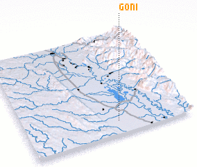 Places with similar names to Goni, Myanmar ::
Disclaimer :: Information on this page comes without warranty of any kind |
||
|
Where is Goni? Elevation and coordinates ::
Latitude (lat): 18°8'0"N Longitude (lon): 96°34'0"E
Elevation (approx.): 33m (map arrows pan, magnifying glasses zoom) |
||
|
Visiting Goni? Hotel/Accommodation ::
Book a hotel in Goni Travel Guide ::
Buy a travel guide for Myanmar rental cars ::
car rental offers GPS waypoint ::
download a GPX waypoint (PoI) of Goni for your GPS receiver
|
||