|
search place name
|
||
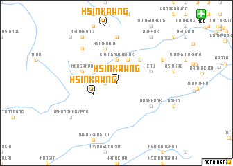
Hsinkawng (Shan, Myanmar)Hsinkawng is a town in the Shan region of Myanmar. An overview map of the region around Hsinkawng is displayed below.
regional and 3d topo map of Hsinkawng, Myanmar ::
Hsinkawng airports ::
The nearest airport is MOG - Mong Hsat, located 17.0 km north east of Hsinkawng.
Other airports nearby include THL - Tachilek Tachileik (84.0 km east), KET - Kengtung (111.1 km north east), Nearby towns ::
Sakhkahsai (1.9km north) //
Loi-kio-ti (1.7km west) //
Kawngmu-ai-sawk (3.7km north) //
Nā-hsi-lik (3.9km north west) //
Mönhkamli (4.1km north east) //
Hsinkawng (3.9km south west) //
Hsa-htawmön (5.1km north east) //
Hpya-hpat (5.5km west) //
Mönsampu (5.5km west) //
En-u (5.5km east) //
Hsinka-haw (5.8km north) //
Hpakhpok (6.4km south east) //
Mē-hkao (7.4km north) //
Wān Hsinhköng (7.6km north west) //
Hpya-möngmöng (7.9km north east) //
Pā-hsak (9.1km north east) //
Hsinhkong (9.1km north west) //
Mē-honghka-yeng (8.9km south west) //
Mönsampu (10.2km north west) //
Hpya-hpat (10.2km north west) //
[all distances 'as the bird flies' and approximate] 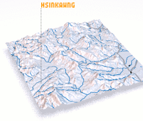 Places with similar names to Hsinkawng, Myanmar ::
// Saingaung (MM)
// Sainggaung (MM)
// Sainggaung (MM)
// Sainggaung (MM)
// Sainggaung (MM)
// Sankawng (MM)
// Sankawng (MM)
// Sankawng (MM)
// Singaing (MM)
// Singaing (MM)
Disclaimer :: Information on this page comes without warranty of any kind |
||
|
Where is Hsinkawng? Elevation and coordinates ::
Latitude (lat): 20°25'0"N Longitude (lon): 99°8'0"E
Elevation (approx.): 980m (map arrows pan, magnifying glasses zoom) |
||
|
Visiting Hsinkawng? Hotel/Accommodation ::
Book a hotel in Hsinkawng Travel Guide ::
Buy a travel guide for Myanmar rental cars ::
car rental offers GPS waypoint ::
download a GPX waypoint (PoI) of Hsinkawng for your GPS receiver
|
||