|
search place name
|
||
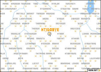
Htidabye (Shan, Myanmar)Htidabye is a town in the Shan region of Myanmar. An overview map of the region around Htidabye is displayed below.
regional and 3d topo map of Htidabye, Myanmar ::
Htidabye airports ::
The nearest airport is HEH - Heho, located 40.3 km north of Htidabye.
Other airports nearby include MDL - Mandalay Intl (168.3 km north west), Nearby towns ::
Payabyu (1.9km south) //
Kawngchin (2.5km south west) //
Namtan (2.5km north west) //
Pandin (2.5km north east) //
Hkwedaung Taung (3.7km north) //
Hkwedaung Myauk (3.7km north) //
Htibon (3.5km east) //
Myenigon (4.1km south west) //
Nawngtu (3.9km south west) //
Pawkin (4.1km south east) //
Singaung (4.1km north west) //
Ywathit (3.9km south east) //
Tharanbu (5.1km north west) //
Ingyingon (5.1km north east) //
Pinzeinbin (5.6km south) //
Myebya (5.2km east) //
Wadaw (5.8km north) //
Paungyaung (5.8km north) //
Thengin (5.5km west) //
Sinzok (5.8km south) //
Kyidaung (6.4km south west) //
Thande (6.4km south west) //
Kyadun (6.6km north east) //
Kyethungon (6.9km west) //
Nampalin (7.4km south) //
Naungwo (7.4km north) //
Payabyu (7.2km west) //
Payame (7.2km west) //
Letpanbin (7.9km south west) //
[all distances 'as the bird flies' and approximate] 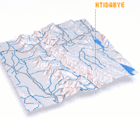
Disclaimer :: Information on this page comes without warranty of any kind |
||
|
Where is Htidabye? Elevation and coordinates ::
Latitude (lat): 20°23'0"N Longitude (lon): 96°47'0"E
Elevation (approx.): 1514m (map arrows pan, magnifying glasses zoom) |
||
|
Visiting Htidabye? Hotel/Accommodation ::
Book a hotel in Htidabye Travel Guide ::
Buy a travel guide for Myanmar rental cars ::
car rental offers GPS waypoint ::
download a GPX waypoint (PoI) of Htidabye for your GPS receiver
|
||