|
search place name
|
||
Inai-long (Shan, Myanmar)Inai-long is a town in the Shan region of Myanmar. An overview map of the region around Inai-long is displayed below.
regional and 3d topo map of Inai-long, Myanmar ::

Inai-long airports ::
The nearest airport is LSH - Lashio, located 12.2 km east of Inai-long.
Other airports nearby include MDL - Mandalay Intl (221.8 km south west), Nearby towns ::
Nā-kang (1.9km south) //
Nā-ha (1.7km west) //
Nā-hoi (1.7km east) //
Pang-yok (3.7km south) //
Pang-htawng (3.4km west) //
Nā-kun (3.4km east) //
Mān-ping (3.9km south west) //
Ho-pong (4.1km south east) //
Hkö-nim (5.0km south east) //
Ho-yau (5.0km south east) //
Ho-het (5.0km north east) //
Nā-kawn-kong-nyaung (5.1km east) //
Kawng-hsan (5.6km south) //
Loi-mān (6.5km north west) //
Ho-tā (6.5km south west) //
Kon-pon (6.5km south east) //
Kongsa (7.4km north) //
Nam-yau (7.6km south) //
I-nai (7.6km south east) //
Pāng-hpyet (8.2km south west) //
Whelung (7.8km south west) //
Pang-kwai-htai (8.2km south east) //
Loi-top (7.8km north west) //
Kon-son (9.0km south east) //
Mān-tā-pè (9.0km south west) //
Loi-lum (8.8km north east) //
[all distances 'as the bird flies' and approximate] 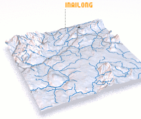 Places with similar names to Inai-long, Myanmar ::
// Inlaung (MM)
Disclaimer :: Information on this page comes without warranty of any kind |
||
|
Where is Inai-long? Elevation and coordinates ::
Latitude (lat): 22°59'0"N Longitude (lon): 97°38'0"E
Elevation (approx.): 778m (map arrows pan, magnifying glasses zoom) |
||
|
Visiting Inai-long? Hotel/Accommodation ::
Book a hotel in Inai-long Travel Guide ::
Buy a travel guide for Myanmar rental cars ::
car rental offers GPS waypoint ::
download a GPX waypoint (PoI) of Inai-long for your GPS receiver
|
||