|
search place name
|
||
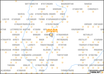
In-gon (Sagaing, Myanmar)In-gon is a town in the Sagaing region of Myanmar. An overview map of the region around In-gon is displayed below.
regional and 3d topo map of In-gon, Myanmar ::
In-gon airports ::
The nearest airport is IMF - Imphal, located 213.2 km north west of In-gon.
Other airports nearby include LSH - Lashio (226.3 km south east), MYT - Myitkyina (231.0 km north east), Nearby towns ::
Kinbungyon (1.9km south) //
Peingan (1.9km south) //
Kobin (1.7km west) //
Chaungzon (2.5km south east) //
Tatkon (2.5km south east) //
Taungbohla (2.5km north east) //
Katcho (2.5km north west) //
In-ga (3.4km east) //
Kyauk-masin (3.4km east) //
Kyeingyaung (3.7km north) //
Aunggon (3.7km north) //
Payadaung (3.9km south east) //
Nga-gwa (4.1km south east) //
Nyaungbintha (4.1km south west) //
Taukkyaudaw (4.1km south west) //
Manbin (4.1km north east) //
Aw-ga (3.9km south west) //
Kaukkwe (3.9km north west) //
Myintha (5.0km south east) //
A-magan (5.1km west) //
The-gyaung (5.1km east) //
Nga-yan-gyaung (5.1km west) //
Shanagyin (5.1km east) //
Kyundawgon (5.6km north) //
Didok (5.6km south) //
Peinnegon (5.4km west) //
Wettu (5.8km south) //
Pazinda (5.8km south) //
Metkalet (5.4km west) //
[all distances 'as the bird flies' and approximate] 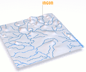 Places with similar names to In-gon, Myanmar ::
Disclaimer :: Information on this page comes without warranty of any kind |
||
|
Where is In-gon? Elevation and coordinates ::
Latitude (lat): 23°53'0"N Longitude (lon): 95°46'0"E
Elevation (approx.): 189m (map arrows pan, magnifying glasses zoom) |
||
|
Visiting In-gon? Hotel/Accommodation ::
Book a hotel in In-gon Travel Guide ::
Buy a travel guide for Myanmar rental cars ::
car rental offers GPS waypoint ::
download a GPX waypoint (PoI) of In-gon for your GPS receiver
|
||