|
search place name
|
||
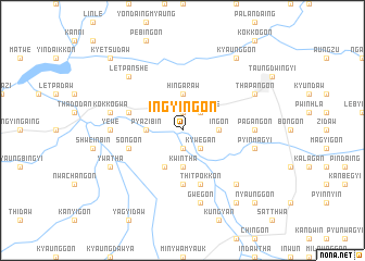
Ingyingon (Myanmar)Ingyingon is a town in Myanmar. An overview map of the region around Ingyingon is displayed below.
regional and 3d topo map of Ingyingon, Myanmar ::
Ingyingon airports ::
The nearest airport is HEH - Heho, located 163.1 km north east of Ingyingon.
Other airports nearby include MDL - Mandalay Intl (199.4 km north), SNW - Thandwe (207.0 km south west), KYP - Kyaukpyu (211.2 km west), Nearby towns ::
Mati (1.9km north) //
Tedaw (1.9km south) //
Letpangwe (2.5km north east) //
Kywegan (2.5km south east) //
Ingôn (3.5km east) //
Hingaraw (3.7km north) //
Aungbauk (3.7km north) //
Kwintha (3.7km south) //
Kanu (3.7km south) //
Pyazibin (3.5km west) //
Myinzu (3.5km west) //
Kobin (4.1km south west) //
Mi-u-aung (5.6km south) //
Thitpokkon (5.8km south) //
Wetchahgan (5.5km west) //
Songon (5.5km west) //
Pagangôn (7.0km east) //
Yewe (7.0km west) //
Pyinmagyi (7.2km east) //
Kokkogwa (7.2km west) //
Gwegon (7.6km south) //
Payakwin (7.6km south east) //
Letpanshe (7.6km north west) //
Thapangon (7.9km north east) //
Ywatha (7.9km south west) //
Kyaunggon (9.1km north east) //
Nyaungbintha (9.1km south east) //
Nyaunggôn (10.2km south east) //
Kyetsudaw (10.2km north west) //
[all distances 'as the bird flies' and approximate] 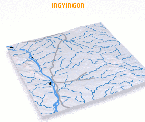 Places with similar names to Ingyingon, Myanmar ::
Disclaimer :: Information on this page comes without warranty of any kind |
||
|
Where is Ingyingon? Elevation and coordinates ::
Latitude (lat): 19°58'0"N Longitude (lon): 95°28'0"E
Elevation (approx.): 117m (map arrows pan, magnifying glasses zoom) |
||
|
Visiting Ingyingon? Hotel/Accommodation ::
Book a hotel in Ingyingon Travel Guide ::
Buy a travel guide for Myanmar rental cars ::
car rental offers GPS waypoint ::
download a GPX waypoint (PoI) of Ingyingon for your GPS receiver
|
||