|
search place name
|
||
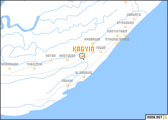
Kāgyin (Ayeyarwady, Myanmar)Kāgyin is a town in the Ayeyarwady region of Myanmar. An overview map of the region around Kāgyin is displayed below.
regional and 3d topo map of Kāgyin, Myanmar ::
Kāgyin airports ::
The nearest airport is RGN - Yangon Intl, located 138.4 km north east of Kāgyin.
Nearby towns ::
Myingazeik (2.6km north west) //
Hseikma (2.6km north east) //
Hpotugôn (3.6km west) //
Alāndaing (3.7km south) //
Yogôn (4.0km north east) //
Hpobagôn (4.1km north east) //
Naukmi (6.6km south west) //
Mayan (7.1km west) //
Nyaunglan-ngu (8.0km north east) //
Kanyintabin (9.0km north east) //
[all distances 'as the bird flies' and approximate] 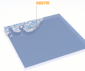 Places with similar names to Kāgyin, Myanmar ::
// Kejayan (ID)
// Kejayan (ID)
// Caojiayuan (CN)
// Gaojiayan (CN)
// Guojiayuan (CN)
// Guojiayuan (CN)
// Qiaojiayuan (CN)
Disclaimer :: Information on this page comes without warranty of any kind |
||
|
Where is Kāgyin? Elevation and coordinates ::
Latitude (lat): 15°49'0"N Longitude (lon): 95°30'0"E
Elevation (approx.): 6m (map arrows pan, magnifying glasses zoom) |
||
|
Visiting Kāgyin? Hotel/Accommodation ::
Book a hotel in Kāgyin Travel Guide ::
Buy a travel guide for Myanmar rental cars ::
car rental offers GPS waypoint ::
download a GPX waypoint (PoI) of Kāgyin for your GPS receiver
|
||