|
search place name
|
||
Kangna (Shan, Myanmar)Kangna is a town in the Shan region of Myanmar. An overview map of the region around Kangna is displayed below.
regional and 3d topo map of Kangna, Myanmar ::

Kangna airports ::
The nearest airport is HEH - Heho, located 81.1 km west of Kangna.
Other airports nearby include MDL - Mandalay Intl (176.7 km north west), MOG - Mong Hsat (189.5 km east), LSH - Lashio (218.5 km north), Nearby towns ::
Wān Maü (1.7km east) //
Ho-na (1.7km east) //
Kongmakmau (1.7km east) //
Hai-nang (1.9km north) //
Pāngmöng (1.9km south) //
Hwè-yaw (2.5km north east) //
Wan Mwe-taw (3.5km east) //
Nawngheng (3.7km south) //
Loi-tap (3.5km west) //
Wān Hwè-möng (3.5km west) //
Kong-yong (3.9km north east) //
Taklit (4.1km north east) //
Mai-yawtkam (4.1km north east) //
Nā-sam (4.1km north west) //
Pānglong (4.1km south east) //
Konghsa (3.9km north west) //
Panglem (5.1km south west) //
Kin-yum (5.2km east) //
Ka-hpi (5.2km west) //
Wengkoi (5.6km north) //
Wān In (5.8km south) //
Long-yok (5.5km west) //
Loi-hkaw (5.5km west) //
Kongkang (5.5km west) //
Longtikawng (5.5km west) //
Ho-pāng (5.8km north) //
Wān Loi-sawn (6.9km west) //
Hwè Ha (6.9km west) //
Konglum (7.6km north) //
[all distances 'as the bird flies' and approximate] 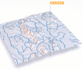 Places with similar names to Kangna, Myanmar ::
Disclaimer :: Information on this page comes without warranty of any kind |
||
|
Where is Kangna? Elevation and coordinates ::
Latitude (lat): 21°1'0"N Longitude (lon): 97°31'0"E
Elevation (approx.): 1354m (map arrows pan, magnifying glasses zoom) |
||
|
Visiting Kangna? Hotel/Accommodation ::
Book a hotel in Kangna Travel Guide ::
Buy a travel guide for Myanmar rental cars ::
car rental offers GPS waypoint ::
download a GPX waypoint (PoI) of Kangna for your GPS receiver
|
||