|
search place name
|
||
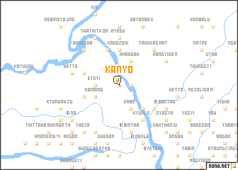
Kanyo (Sagaing, Myanmar)Kanyo is a town in the Sagaing region of Myanmar. An overview map of the region around Kanyo is displayed below.
regional and 3d topo map of Kanyo, Myanmar ::
Kanyo airports ::
The nearest airport is MDL - Mandalay Intl, located 167.6 km south of Kanyo.
Other airports nearby include IMF - Imphal (237.8 km north west), Nearby towns ::
Mugwa (0.0km north) //
Linda-an (1.9km north) //
Kadaungyin (1.7km east) //
Etkyi (3.4km west) //
Hmawdaw (4.1km north east) //
Kon-aing (3.9km south west) //
Kabe (4.1km south east) //
Beyin (4.1km south east) //
Mogaung (5.0km south east) //
Kadozeik (5.6km north) //
Mezaligon (5.4km west) //
Mudein (5.8km north) //
Ywashe (5.4km west) //
Kyunle (6.5km south east) //
Nyaungbingyi (6.3km south east) //
Zigon (6.3km south east) //
Myedu (7.4km north) //
Wetto (7.1km west) //
Inbintha (7.6km south) //
Taukkashat (7.6km north east) //
Aungzwa (7.6km north west) //
Poktaw (8.2km north west) //
Ywathitkon (8.2km north west) //
Sagon (8.2km north west) //
Kangyigon (7.8km north east) //
Tasegye (8.2km south west) //
Inboktaw (7.8km south east) //
Mingon (8.8km south east) //
Inna (8.8km south west) //
[all distances 'as the bird flies' and approximate] 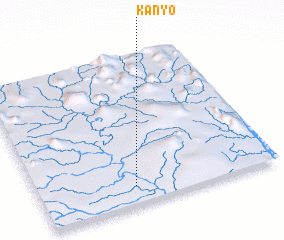 Places with similar names to Kanyo, Myanmar ::
Disclaimer :: Information on this page comes without warranty of any kind |
||
|
Where is Kanyo? Elevation and coordinates ::
Latitude (lat): 23°7'0"N Longitude (lon): 95°24'0"E
Elevation (approx.): 130m (map arrows pan, magnifying glasses zoom) |
||
|
Visiting Kanyo? Hotel/Accommodation ::
Book a hotel in Kanyo Travel Guide ::
Buy a travel guide for Myanmar rental cars ::
car rental offers GPS waypoint ::
download a GPX waypoint (PoI) of Kanyo for your GPS receiver
|
||