|
search place name
|
||
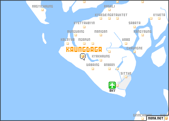
Kaungdaga (Rakhine, Myanmar)Kaungdaga is a town in the Rakhine region of Myanmar. An overview map of the region around Kaungdaga is displayed below.
regional and 3d topo map of Kaungdaga, Myanmar ::
Kaungdaga airports ::
The nearest airport is AKY - Sittwe, located 8.1 km south east of Kaungdaga.
Other airports nearby include KYP - Kyaukpyu (112.6 km south east), CXB - Cox's Bazar Coxs Bazar (166.2 km north west), SNW - Thandwe (246.3 km south east), Nearby towns ::
Dabaing (2.5km south east) //
Kyakhaung (3.5km east) //
Ngapun (3.7km north) //
Mawnubyin (4.1km north east) //
Thanthama (5.1km north west) //
Kala-ywa (5.1km north west) //
Anbari (5.5km east) //
Ywathitke (5.5km east) //
Aungdaing (5.8km north) //
Narigan (6.6km north east) //
Kyettawbyin (7.4km north) //
Yegyanbyin (7.4km north) //
Khadinbaik (7.4km north) //
Thinganet (7.2km east) //
Myoma (8.9km south east) //
[all distances 'as the bird flies' and approximate] 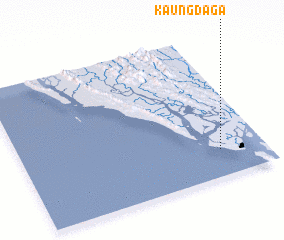 Places with similar names to Kaungdaga, Myanmar ::
// Cancatac (PH)
// Gangadogo (BF)
// Gounou Kodégué (TD)
// Gangtok (IN)
// Kuankuduk (KZ)
// Gangadīk (IR)
// Kangdŏk (KR)
// Kangaodagué (ML)
// Kangdok (KR)
// Qingtaiqiu (CN)
Disclaimer :: Information on this page comes without warranty of any kind |
||
|
Where is Kaungdaga? Elevation and coordinates ::
Latitude (lat): 20°11'0"N Longitude (lon): 92°49'0"E
Elevation (approx.): 4m (map arrows pan, magnifying glasses zoom) |
||
|
Visiting Kaungdaga? Hotel/Accommodation ::
Book a hotel in Kaungdaga Travel Guide ::
Buy a travel guide for Myanmar rental cars ::
car rental offers GPS waypoint ::
download a GPX waypoint (PoI) of Kaungdaga for your GPS receiver
|
||