|
search place name
|
||
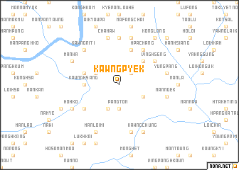
Kawngpyek (Shan, Myanmar)Kawngpyek is a town in the Shan region of Myanmar. An overview map of the region around Kawngpyek is displayed below.
regional and 3d topo map of Kawngpyek, Myanmar ::
Kawngpyek airports ::
The nearest airport is LSH - Lashio, located 108.1 km west of Kawngpyek.
Other airports nearby include KET - Kengtung (226.1 km south east), Nearby towns ::
Pangnoi (2.5km north east) //
Pangtom (3.7km south) //
Mān Nawng (4.1km south west) //
Mān Nampung (3.9km north west) //
Mān Namsi-yang (3.9km south east) //
Mān Hpa (5.0km north east) //
Kawnghsang (5.1km west) //
Mān Chan (5.4km west) //
Ta-lu-pa (5.8km north) //
Mān Htam (6.3km south west) //
Hpa-chang (6.5km north east) //
Ving Hseng (6.3km north east) //
Pang Long (7.4km north) //
Na-hkang (7.6km south) //
Chamaw (7.6km north) //
Mān Ngek (7.1km east) //
Yungpang (7.1km east) //
Hsi-hpa-chai (7.6km north) //
Kawng Ri-ti (7.6km north west) //
Ho-hko (7.8km south west) //
Mān Loi-mi (8.2km south west) //
Mān Wa (7.8km north west) //
Kawngchung (8.2km south east) //
Konglong (9.0km north east) //
Nammu (10.1km north east) //
[all distances 'as the bird flies' and approximate] 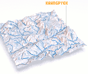 Places with similar names to Kawngpyek, Myanmar ::
// Kong Pyek (MM)
Disclaimer :: Information on this page comes without warranty of any kind |
||
|
Where is Kawngpyek? Elevation and coordinates ::
Latitude (lat): 23°11'0"N Longitude (lon): 98°47'0"E
Elevation (approx.): 1390m (map arrows pan, magnifying glasses zoom) |
||
|
Visiting Kawngpyek? Hotel/Accommodation ::
Book a hotel in Kawngpyek Travel Guide ::
Buy a travel guide for Myanmar rental cars ::
car rental offers GPS waypoint ::
download a GPX waypoint (PoI) of Kawngpyek for your GPS receiver
|
||