|
search place name
|
||
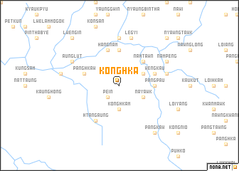
Konghka (Shan, Myanmar)Konghka is a town in the Shan region of Myanmar. An overview map of the region around Konghka is displayed below.
regional and 3d topo map of Konghka, Myanmar ::
Konghka airports ::
The nearest airport is LSH - Lashio, located 125.6 km east of Konghka.
Other airports nearby include MDL - Mandalay Intl (131.8 km south west), Nearby towns ::
Pe-in (2.5km south west) //
Konghkam (3.7km south) //
Nyaungbintha (3.7km south) //
Sewau (3.9km north east) //
Nayawk (3.9km south east) //
Nahtawn (5.0km north east) //
Pangpau (5.1km east) //
Panghkaw (5.6km north) //
Wengkau (5.5km east) //
Panghkaw (5.5km west) //
Hangnam (5.8km north) //
Nakyaing (5.8km north) //
Htangaung (6.5km south west) //
Kyauktalon (7.4km north) //
Legyi (7.6km north) //
Möng Long (7.1km east) //
Aunglut (7.8km north west) //
Nampeng (7.8km north east) //
Pangkaw (9.0km south east) //
Nahkam (10.1km north east) //
Lwe-ngin (10.1km north west) //
[all distances 'as the bird flies' and approximate] 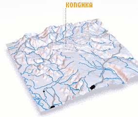 Places with similar names to Konghka, Myanmar ::
Disclaimer :: Information on this page comes without warranty of any kind |
||
|
Where is Konghka? Elevation and coordinates ::
Latitude (lat): 22°46'0"N Longitude (lon): 96°33'0"E
Elevation (approx.): 998m (map arrows pan, magnifying glasses zoom) |
||
|
Visiting Konghka? Hotel/Accommodation ::
Book a hotel in Konghka Travel Guide ::
Buy a travel guide for Myanmar rental cars ::
car rental offers GPS waypoint ::
download a GPX waypoint (PoI) of Konghka for your GPS receiver
|
||