|
search place name
|
||
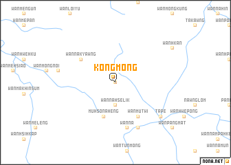
Kongmōng (Shan, Myanmar)Kongmōng is a town in the Shan region of Myanmar. An overview map of the region around Kongmōng is displayed below.
regional and 3d topo map of Kongmōng, Myanmar ::
Kongmōng airports ::
The nearest airport is MOG - Mong Hsat, located 48.8 km south east of Kongmōng.
Other airports nearby include KET - Kengtung (87.1 km north east), THL - Tachilek Tachileik (110.4 km east), Nearby towns ::
Na-möng (0.0km north) //
Wān Nā-hse-lik (3.7km south) //
Muhso-nā-heng (5.8km south) //
Wān Nā-kyawng (6.4km north west) //
Wān Mu-twi (6.6km south east) //
Wān Nā (7.6km south) //
Wān Mè-pawng (8.2km south east) //
Tā Pe (8.9km south east) //
[all distances 'as the bird flies' and approximate]  Places with similar names to Kongmōng, Myanmar ::
// Canguming (PH)
// Cangmunag (PH)
// Gongming (SD)
// Kuang-ming (TW)
// Hkawngmeng (MM)
// Kongmong (MM)
// Gangmenkou (CN)
// Gongming (CN)
// Guangming (CN)
// Guangming (CN)
Disclaimer :: Information on this page comes without warranty of any kind |
||
|
Where is Kongmōng? Elevation and coordinates ::
Latitude (lat): 20°51'0"N Longitude (lon): 98°57'0"E
Elevation (approx.): 1056m (map arrows pan, magnifying glasses zoom) |
||
|
Visiting Kongmōng? Hotel/Accommodation ::
Book a hotel in Kongmōng Travel Guide ::
Buy a travel guide for Myanmar rental cars ::
car rental offers GPS waypoint ::
download a GPX waypoint (PoI) of Kongmōng for your GPS receiver
|
||