|
search place name
|
||
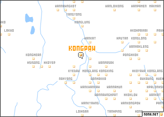
Kongpaw (Shan, Myanmar)Kongpaw is a town in the Shan region of Myanmar. An overview map of the region around Kongpaw is displayed below.
regional and 3d topo map of Kongpaw, Myanmar ::
Kongpaw airports ::
The nearest airport is HEH - Heho, located 93.1 km south west of Kongpaw.
Other airports nearby include MDL - Mandalay Intl (143.9 km west), LSH - Lashio (178.2 km north), MOG - Mong Hsat (223.5 km south east), Nearby towns ::
Lakting (1.7km east) //
Tawn Hsan (2.5km north east) //
Pang Hkan (2.5km south west) //
Kong Ten (2.5km south east) //
Nā Tawng (2.5km south east) //
Wan Kat (4.1km north east) //
Nawng Hko Hkam (4.1km north east) //
Tawng (4.1km north east) //
Kye-daw (4.1km south west) //
Möng Lang (4.1km south east) //
Wen Long (5.1km south east) //
Nam Awn (5.8km south) //
Myawng U (5.8km south) //
Wānpa Sak (5.5km east) //
Nam-yang (6.5km south west) //
Wan Mak Ka (6.5km south east) //
Kong King (6.4km south east) //
Wan Ho-nā-mak-ik (6.4km south east) //
Kong Lüng (7.4km north) //
Wān Hsa-lawng (7.4km north) //
Hko-yep (7.1km west) //
Wan Kwan Kaw (7.6km south) //
Nā Tat (8.2km south east) //
Wan Nā-mun (10.1km south east) //
[all distances 'as the bird flies' and approximate] 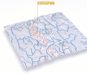 Places with similar names to Kongpaw, Myanmar ::
Disclaimer :: Information on this page comes without warranty of any kind |
||
|
Where is Kongpaw? Elevation and coordinates ::
Latitude (lat): 21°25'0"N Longitude (lon): 97°20'0"E
Elevation (approx.): 741m (map arrows pan, magnifying glasses zoom) |
||
|
Visiting Kongpaw? Hotel/Accommodation ::
Book a hotel in Kongpaw Travel Guide ::
Buy a travel guide for Myanmar rental cars ::
car rental offers GPS waypoint ::
download a GPX waypoint (PoI) of Kongpaw for your GPS receiver
|
||