|
search place name
|
||
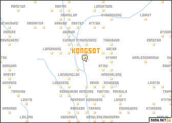
Kongsot (Shan, Myanmar)Kongsot is a town in the Shan region of Myanmar. An overview map of the region around Kongsot is displayed below.
regional and 3d topo map of Kongsot, Myanmar ::
Kongsot airports ::
The nearest airport is HEH - Heho, located 74.0 km north west of Kongsot.
Other airports nearby include MDL - Mandalay Intl (209.3 km north west), Nearby towns ::
Nammawlek (1.9km north) //
Nawngywi (1.9km north) //
Makkawk (2.5km south west) //
Lenleng (2.5km north west) //
Nyawngsang (3.7km north) //
Hti-su (3.9km south east) //
Pangti (3.9km north east) //
Könglaw (4.1km north west) //
Nawnglek (3.9km north west) //
Loi-sawnglok (5.1km south west) //
Kunmun (5.1km north west) //
Htiman (5.2km east) //
Nawngpong (5.6km south) //
Nyaungbintha (5.5km east) //
Chitiwabwa (5.5km west) //
Tönghsöngkalo (5.5km east) //
Wācha (5.5km east) //
Mahai (5.8km south) //
Hpakhālong (6.4km south east) //
Temong (6.6km south east) //
Namaw (6.4km north east) //
Tahkawha (6.4km north east) //
Wankun (6.6km north west) //
Pangkan (6.6km south west) //
Wannawng (7.4km south) //
Wengkau (7.4km south) //
Nam-yat (7.6km north) //
Longmawng (7.2km west) //
Htiyaw (7.6km north) //
[all distances 'as the bird flies' and approximate] 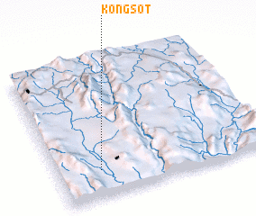 Places with similar names to Kongsot, Myanmar ::
Disclaimer :: Information on this page comes without warranty of any kind |
||
|
Where is Kongsot? Elevation and coordinates ::
Latitude (lat): 20°12'0"N Longitude (lon): 97°12'0"E
Elevation (approx.): 829m (map arrows pan, magnifying glasses zoom) |
||
|
Visiting Kongsot? Hotel/Accommodation ::
Book a hotel in Kongsot Travel Guide ::
Buy a travel guide for Myanmar rental cars ::
car rental offers GPS waypoint ::
download a GPX waypoint (PoI) of Kongsot for your GPS receiver
|
||