|
search place name
|
||
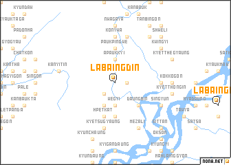
Labaingdin (Sagaing, Myanmar)Labaingdin is a town in the Sagaing region of Myanmar. An overview map of the region around Labaingdin is displayed below.
regional and 3d topo map of Labaingdin, Myanmar ::
Labaingdin airports ::
The nearest airport is LSH - Lashio, located 194.7 km south east of Labaingdin.
Other airports nearby include MYT - Myitkyina (222.4 km north east), Nearby towns ::
Kunshin (1.7km east) //
Tawma (2.5km south west) //
Sinbyuzeik (3.7km north) //
Apaukkyi (3.7km north) //
Wegyi (3.7km south) //
Mayathein (4.1km south west) //
Migyaungaing (5.0km south east) //
Daungbin (5.0km south east) //
Wabogyaung (5.6km south) //
Paukpingwe (5.6km north) //
Hpetkat (5.8km south) //
Konywa (7.4km north) //
Pôngôngyi (6.8km east) //
Myebalin (7.6km north) //
Kyetsugyaung (7.6km south) //
Mezali (8.2km south east) //
Nyaungbintha (8.2km south east) //
Singyun (7.7km south east) //
Thaunggyi (7.7km south east) //
Pyinzu (9.0km north east) //
Kwingyi (8.8km north east) //
Paukkon (8.8km north east) //
Shweli (10.0km north east) //
Sittan (10.1km south east) //
[all distances 'as the bird flies' and approximate] 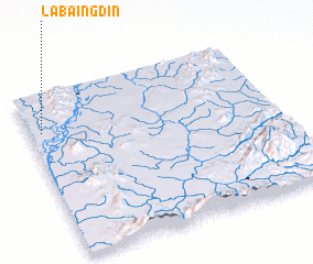 Places with similar names to Labaingdin, Myanmar ::
// Labaingdin (MM)
Disclaimer :: Information on this page comes without warranty of any kind |
||
|
Where is Labaingdin? Elevation and coordinates ::
Latitude (lat): 23°46'0"N Longitude (lon): 96°3'0"E
Elevation (approx.): 89m (map arrows pan, magnifying glasses zoom) |
||
|
Visiting Labaingdin? Hotel/Accommodation ::
Book a hotel in Labaingdin Travel Guide ::
Buy a travel guide for Myanmar rental cars ::
car rental offers GPS waypoint ::
download a GPX waypoint (PoI) of Labaingdin for your GPS receiver
|
||