|
search place name
|
||
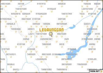
Ledaunggan (Mandalay, Myanmar)Ledaunggan is a town in the Mandalay region of Myanmar. An overview map of the region around Ledaunggan is displayed below.
regional and 3d topo map of Ledaunggan, Myanmar ::
Ledaunggan airports ::
The nearest airport is MDL - Mandalay Intl, located 72.5 km north of Ledaunggan.
Other airports nearby include HEH - Heho (114.6 km east), Nearby towns ::
Okpogan (0.0km north) //
Zibyugan (1.9km north) //
Kywegyaung (1.7km east) //
Kanthit (2.5km south east) //
Kunhnachet (2.5km south west) //
Kyinywa (2.5km north east) //
Tawbon (3.5km east) //
Thayetkan (3.5km west) //
Magyigan (3.5km east) //
Kyatti (3.9km north east) //
Kugyi (3.9km north west) //
Tabingan (4.1km south west) //
Yondaw (4.1km north west) //
Mayo (5.1km south east) //
Natsingon (5.1km north east) //
Nyaungbin (5.1km north west) //
Kyagan (5.2km west) //
Kuni (5.5km east) //
Myetthigyin (5.5km west) //
Nyaungbinde (6.4km south west) //
Kanywa (6.5km north east) //
Kanswe (6.4km north west) //
Wagwa (6.4km north west) //
Legyi (6.9km west) //
Tamagyi (7.6km south) //
Gyogya-u (7.6km south) //
Magyigon (7.6km south) //
Ywadan (7.2km west) //
Paungyodaw (7.2km west) //
[all distances 'as the bird flies' and approximate] 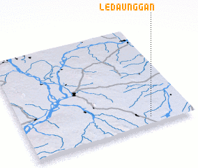 Places with similar names to Ledaunggan, Myanmar ::
// Latañgan (PH)
// Lutongan (PH)
// Lutuñgan (PH)
// Lutungan (PH)
// Lutenkena (CD)
// Lutungan (ID)
// Latīngān (IR)
// Lītangān (IR)
// Ley Tangan (GN)
// La Tinguiña (PE)
Disclaimer :: Information on this page comes without warranty of any kind |
||
|
Where is Ledaunggan? Elevation and coordinates ::
Latitude (lat): 21°5'0"N Longitude (lon): 95°45'0"E
Elevation (approx.): 228m (map arrows pan, magnifying glasses zoom) |
||
|
Visiting Ledaunggan? Hotel/Accommodation ::
Book a hotel in Ledaunggan Travel Guide ::
Buy a travel guide for Myanmar rental cars ::
car rental offers GPS waypoint ::
download a GPX waypoint (PoI) of Ledaunggan for your GPS receiver
|
||