|
search place name
|
||
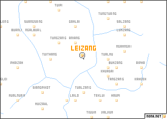
Leizang (Chin, Myanmar)Leizang is a town in the Chin region of Myanmar. An overview map of the region around Leizang is displayed below.
regional and 3d topo map of Leizang, Myanmar ::
Leizang airports ::
The nearest airport is AJL - Aizwal Aizawl, located 91.2 km west of Leizang.
Other airports nearby include IMF - Imphal (143.6 km north), IXS - Silchar (172.4 km north west), IXH - Kailashahar (190.6 km north west), CGP - Chittagong Shah Amanat Intl (232.8 km south west), Nearby towns ::
Aniang (4.1km north west) //
Tualmu (5.1km east) //
Mongken (5.4km east) //
Khuadai (6.3km south east) //
Tungzang (6.3km north west) //
Tualzang (7.4km south) //
Tuithang (6.8km west) //
Bumzang (7.0km east) //
Gamlai (7.6km north) //
Tangzang (8.8km south east) //
[all distances 'as the bird flies' and approximate] 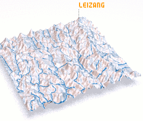 Places with similar names to Leizang, Myanmar ::
Disclaimer :: Information on this page comes without warranty of any kind |
||
|
Where is Leizang? Elevation and coordinates ::
Latitude (lat): 23°29'0"N Longitude (lon): 93°39'0"E
Elevation (approx.): 1078m (map arrows pan, magnifying glasses zoom) |
||
|
Visiting Leizang? Hotel/Accommodation ::
Book a hotel in Leizang Travel Guide ::
Buy a travel guide for Myanmar rental cars ::
car rental offers GPS waypoint ::
download a GPX waypoint (PoI) of Leizang for your GPS receiver
|
||