|
search place name
|
||
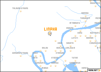
Linpha (Sagaing, Myanmar)Linpha is a town in the Sagaing region of Myanmar. An overview map of the region around Linpha is displayed below.
regional and 3d topo map of Linpha, Myanmar ::
Linpha airports ::
The nearest airport is IMF - Imphal, located 96.1 km north west of Linpha.
Other airports nearby include IXS - Silchar (185.3 km north west), AJL - Aizwal Aizawl (195.5 km west), Nearby towns ::
Thayetkon (2.5km south east) //
Kawe (5.0km south east) //
Nansima (5.8km south) //
Ahlaw (5.8km south) //
Hehlaw (6.5km south east) //
Makyaik (6.5km south west) //
Pa-aung (7.0km east) //
Kyandan (8.1km south east) //
Ngapyawdaw (8.1km south west) //
Sagata (7.7km south east) //
Thazi (9.0km south west) //
Lanlegwa (8.8km south east) //
Sittaung (10.0km south west) //
Sittaw (10.0km south west) //
[all distances 'as the bird flies' and approximate] 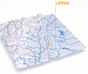 Places with similar names to Linpha, Myanmar ::
Disclaimer :: Information on this page comes without warranty of any kind |
||
|
Where is Linpha? Elevation and coordinates ::
Latitude (lat): 24°14'0"N Longitude (lon): 94°39'0"E
Elevation (approx.): 137m (map arrows pan, magnifying glasses zoom) |
||
|
Visiting Linpha? Hotel/Accommodation ::
Book a hotel in Linpha Travel Guide ::
Buy a travel guide for Myanmar rental cars ::
car rental offers GPS waypoint ::
download a GPX waypoint (PoI) of Linpha for your GPS receiver
|
||