|
search place name
|
||
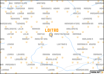
Loi-tao (Shan, Myanmar)Loi-tao is a town in the Shan region of Myanmar. An overview map of the region around Loi-tao is displayed below.
regional and 3d topo map of Loi-tao, Myanmar ::
Loi-tao airports ::
The nearest airport is LSH - Lashio, located 49.1 km south west of Loi-tao.
Other airports nearby include KET - Kengtung (259.1 km south east), Nearby towns ::
Pāngtawngkwe (3.4km east) //
Namtuk (3.4km west) //
Mān Hke (3.4km west) //
Mān Maü (4.1km north west) //
Pāng-ya-yong (3.9km south west) //
Luktawng (5.0km south east) //
Su-tek (5.0km south west) //
Hkenghpa-kun (5.6km north) //
Hwe Tawng (5.8km north) //
Namhkai (5.4km west) //
Mān Hsanhtong (5.4km east) //
Pāngnoi (6.8km west) //
Mān Lu-hsaw (7.1km east) //
Wawla-pong (7.1km east) //
Kawngmu (7.6km south) //
Nammaw (7.6km south) //
Namnok (7.6km north) //
Nawngheng (7.6km north west) //
Mān Hsanhtong (7.8km north east) //
Nawngleng (7.8km north west) //
Nawnghkam (8.2km south east) //
Mān Kan (10.1km north west) //
[all distances 'as the bird flies' and approximate] 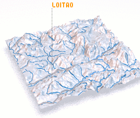 Places with similar names to Loi-tao, Myanmar ::
Disclaimer :: Information on this page comes without warranty of any kind |
||
|
Where is Loi-tao? Elevation and coordinates ::
Latitude (lat): 23°12'0"N Longitude (lon): 98°10'0"E
Elevation (approx.): 1938m (map arrows pan, magnifying glasses zoom) |
||
|
Visiting Loi-tao? Hotel/Accommodation ::
Book a hotel in Loi-tao Travel Guide ::
Buy a travel guide for Myanmar rental cars ::
car rental offers GPS waypoint ::
download a GPX waypoint (PoI) of Loi-tao for your GPS receiver
|
||