|
search place name
|
||
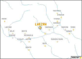
Lwezaw (Rakhine, Myanmar)Lwezaw is a town in the Rakhine region of Myanmar. An overview map of the region around Lwezaw is displayed below.
regional and 3d topo map of Lwezaw, Myanmar ::
Lwezaw airports ::
The nearest airport is AKY - Sittwe, located 99.7 km south west of Lwezaw.
Other airports nearby include KYP - Kyaukpyu (134.3 km south), CXB - Cox's Bazar Coxs Bazar (198.9 km north west), CGP - Chittagong Shah Amanat Intl (262.6 km north west), Nearby towns ::
Lwegan (1.9km north) //
Hezawgyi (2.5km south east) //
Yaungdwe (3.5km east) //
Hezawgale (6.4km south west) //
Buzo (7.6km south) //
Hkaingzi (7.2km east) //
Hehtin (7.2km west) //
Kinywa (7.6km south west) //
Kyundu (7.9km north east) //
Ngadongyaung (8.9km south east) //
Yugyaung (10.2km north east) //
[all distances 'as the bird flies' and approximate] 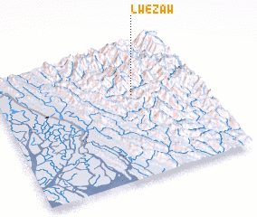 Places with similar names to Lwezaw, Myanmar ::
Disclaimer :: Information on this page comes without warranty of any kind |
||
|
Where is Lwezaw? Elevation and coordinates ::
Latitude (lat): 20°38'0"N Longitude (lon): 93°40'0"E
Elevation (approx.): 334m (map arrows pan, magnifying glasses zoom) |
||
|
Visiting Lwezaw? Hotel/Accommodation ::
Book a hotel in Lwezaw Travel Guide ::
Buy a travel guide for Myanmar rental cars ::
car rental offers GPS waypoint ::
download a GPX waypoint (PoI) of Lwezaw for your GPS receiver
|
||