|
search place name
|
||
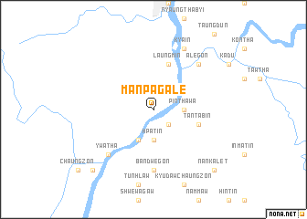
Manpagale (Sagaing, Myanmar)Manpagale is a town in the Sagaing region of Myanmar. An overview map of the region around Manpagale is displayed below.
regional and 3d topo map of Manpagale, Myanmar ::
Manpagale airports ::
The nearest airport is IMF - Imphal, located 146.9 km north of Manpagale.
Other airports nearby include AJL - Aizwal Aizawl (165.0 km west), IXS - Silchar (211.6 km north west), MDL - Mandalay Intl (258.2 km south east), Nearby towns ::
Ye-u-gon (2.5km south east) //
Pinthawa (3.4km east) //
Hpatin (3.7km south) //
Nanzalein (4.1km south west) //
Laungmin (5.8km north) //
Tantabin (5.4km east) //
Bandwegon (7.4km south) //
Alegon (7.5km north east) //
Ywatha (7.5km south west) //
Kya-in (8.2km north east) //
Nankalet (10.1km south east) //
Paluzawa (10.1km south west) //
[all distances 'as the bird flies' and approximate] 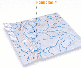 Places with similar names to Manpagale, Myanmar ::
// Mān Hpeklü (MM)
Disclaimer :: Information on this page comes without warranty of any kind |
||
|
Where is Manpagale? Elevation and coordinates ::
Latitude (lat): 23°31'0"N Longitude (lon): 94°24'0"E
Elevation (approx.): 105m (map arrows pan, magnifying glasses zoom) |
||
|
Visiting Manpagale? Hotel/Accommodation ::
Book a hotel in Manpagale Travel Guide ::
Buy a travel guide for Myanmar rental cars ::
car rental offers GPS waypoint ::
download a GPX waypoint (PoI) of Manpagale for your GPS receiver
|
||