|
search place name
|
||
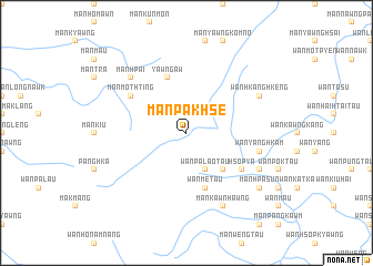
Mān Pakhse (Shan, Myanmar)Mān Pakhse is a town in the Shan region of Myanmar. An overview map of the region around Mān Pakhse is displayed below.
regional and 3d topo map of Mān Pakhse, Myanmar ::
Mān Pakhse airports ::
The nearest airport is KET - Kengtung, located 105.2 km south east of Mān Pakhse.
Other airports nearby include LSH - Lashio (164.2 km north west), MOG - Mong Hsat (168.8 km south), THL - Tachilek Tachileik (197.3 km south east), Nearby towns ::
Mān Nawk (2.5km north east) //
Wān Pā-lao-nō (4.1km south east) //
Wān Pa-lao-tau (4.1km south east) //
Wān Me-nö (5.1km south east) //
Wān Mè-taü (5.8km south) //
Yawng Aw (5.8km north) //
Mān Mothting (6.3km north west) //
Hsop Ya (6.3km south east) //
Wān Yanghkam (7.1km east) //
Mān Hpai (7.6km north west) //
Wān Hkanghkeng (7.8km north east) //
Wān Su (7.8km south east) //
Mān Kāt (7.8km south east) //
Mān Kawnhawng (8.2km south east) //
Mān Pānghūng (8.8km south east) //
Mān Hpa-sun (8.8km south east) //
[all distances 'as the bird flies' and approximate]  Places with similar names to Mān Pakhse, Myanmar ::
// Many Peaks (AU)
// Manypeaks (AU)
Disclaimer :: Information on this page comes without warranty of any kind |
||
|
Where is Mān Pakhse? Elevation and coordinates ::
Latitude (lat): 22°1'0"N Longitude (lon): 98°58'0"E
Elevation (approx.): 948m (map arrows pan, magnifying glasses zoom) |
||
|
Visiting Mān Pakhse? Hotel/Accommodation ::
Book a hotel in Mān Pakhse Travel Guide ::
Buy a travel guide for Myanmar rental cars ::
car rental offers GPS waypoint ::
download a GPX waypoint (PoI) of Mān Pakhse for your GPS receiver
|
||