|
search place name
|
||
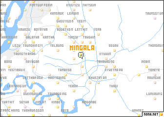
Mingala (Mandalay, Myanmar)Mingala is a town in the Mandalay region of Myanmar. An overview map of the region around Mingala is displayed below.
regional and 3d topo map of Mingala, Myanmar ::
Mingala airports ::
The nearest airport is MDL - Mandalay Intl, located 29.2 km south west of Mingala.
Other airports nearby include HEH - Heho (140.8 km south east), LSH - Lashio (201.9 km north east), Nearby towns ::
Sandabuli (1.9km south) //
Tawdwin (1.9km south) //
Nyaungwun (1.7km west) //
Kyaukmiywa (1.9km north) //
Uyingale (2.5km north west) //
Maingleze (3.7km south) //
Myodaw (3.7km north) //
Wagingon (4.1km north west) //
Ywozu (4.1km north west) //
Tawdwin (4.1km north east) //
Tamokso (5.1km south west) //
Kyuwun (5.2km east) //
Ongyaw (5.2km east) //
Letthit (5.6km north) //
Tamadaung (5.5km east) //
Yelaung (5.5km west) //
Thinbangon (5.5km west) //
Shanywagale (5.8km south) //
Bodetkon (6.5km north west) //
Mithwebok (6.5km south east) //
Shwezayan (6.5km south east) //
Yema (6.5km north east) //
Yegyi (7.4km north) //
Yebok (7.6km south) //
Su-gyaung (7.1km east) //
Sedaw (7.1km east) //
Magyigaing (7.6km south west) //
Shwebaukpin (7.6km south west) //
Sauktawwa (7.8km south west) //
[all distances 'as the bird flies' and approximate] 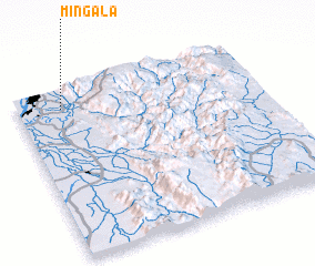 Places with similar names to Mingala, Myanmar ::
// Managale (MM)
// Mangla (MM)
// Mān Ka-lao (MM)
// Mān Kalu (MM)
// Mān Nawkla (MM)
// Maungla (MM)
// Maunglaw (MM)
// Mingala (MM)
// Möng La (MM)
// Möng La (MM)
Disclaimer :: Information on this page comes without warranty of any kind |
||
|
Where is Mingala? Elevation and coordinates ::
Latitude (lat): 21°53'0"N Longitude (lon): 96°11'0"E
Elevation (approx.): 82m (map arrows pan, magnifying glasses zoom) |
||
|
Visiting Mingala? Hotel/Accommodation ::
Book a hotel in Mingala Travel Guide ::
Buy a travel guide for Myanmar rental cars ::
car rental offers GPS waypoint ::
download a GPX waypoint (PoI) of Mingala for your GPS receiver
|
||