|
search place name
|
||
Möng Nai (Shan, Myanmar)Möng Nai is a town in the Shan region of Myanmar. An overview map of the region around Möng Nai is displayed below.
regional and 3d topo map of Möng Nai, Myanmar ::

Möng Nai airports ::
The nearest airport is HEH - Heho, located 114.9 km west of Möng Nai.
Other airports nearby include MOG - Mong Hsat (145.0 km east), KET - Kengtung (203.6 km north east), MDL - Mandalay Intl (236.1 km north west), Nearby towns ::
Hsihsong (1.9km north) //
Nammawhsawm (1.9km north) //
Loihkin (1.7km west) //
Kongmakka (2.5km north west) //
Mwetaw (3.7km north) //
Pahu (3.5km west) //
Hweho (3.7km south) //
Nāong (3.9km south east) //
Knoglong (3.9km south west) //
Nawngkaiyawn (5.1km north east) //
Ywemanywa (5.1km north east) //
Tohsai (5.1km south east) //
Hanghawng (5.1km south east) //
Umlu (5.1km south west) //
Konglom (5.2km west) //
Wān Keng (5.6km north) //
Maklangsin (5.5km east) //
Melhtila (5.5km east) //
Longhkat (5.8km south) //
Kenglong (5.8km north) //
Nayawng (6.4km north west) //
Nawnglok (6.6km north west) //
Makka (6.4km south east) //
Kongkaw (7.4km north) //
Katkeng (7.6km north) //
Longsam (7.2km east) //
Makhkaw (7.2km east) //
Hwesong (7.2km west) //
Paiteaulonghu (7.6km south east) //
[all distances 'as the bird flies' and approximate] 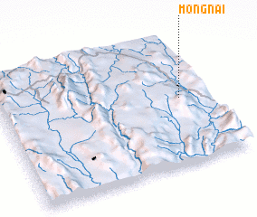 Places with similar names to Möng Nai, Myanmar ::
Disclaimer :: Information on this page comes without warranty of any kind |
||
|
Where is Möng Nai? Elevation and coordinates ::
Latitude (lat): 20°31'0"N Longitude (lon): 97°52'0"E
Elevation (approx.): 829m (map arrows pan, magnifying glasses zoom) |
||
|
Visiting Möng Nai? Hotel/Accommodation ::
Book a hotel in Möng Nai Travel Guide ::
Buy a travel guide for Myanmar rental cars ::
car rental offers GPS waypoint ::
download a GPX waypoint (PoI) of Möng Nai for your GPS receiver
|
||