|
search place name
|
||
Mraunggri (Rakhine, Myanmar)Mraunggri is a town in the Rakhine region of Myanmar. An overview map of the region around Mraunggri is displayed below.
regional and 3d topo map of Mraunggri, Myanmar ::

Mraunggri airports ::
The nearest airport is AKY - Sittwe, located 26.0 km south of Mraunggri.
Other airports nearby include KYP - Kyaukpyu (118.3 km south east), CXB - Cox's Bazar Coxs Bazar (160.5 km north west), CGP - Chittagong Shah Amanat Intl (242.0 km north west), SNW - Thandwe (251.7 km south east), Nearby towns ::
Ame-gin (2.5km north west) //
Ahtôkthe (2.5km south west) //
Yachaung (3.7km south) //
Letwesadain (3.9km north east) //
Modinbyin (4.1km north west) //
Padetha (4.1km south west) //
Kyaukseik (5.5km east) //
Ponnagyun (5.5km east) //
Alechaung (5.5km west) //
Mingan (6.6km south east) //
Dodan (6.6km north west) //
Kundaung (6.6km south west) //
Metkalagya (7.2km west) //
Yongon (9.1km north east) //
[all distances 'as the bird flies' and approximate] 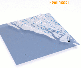 Places with similar names to Mraunggri, Myanmar ::
// Marang Ara (MY)
// Murangara (BI)
// Mawrongor (IN)
// Marancar (ID)
// Muringari (KE)
// Mar Negro (MX)
// Mura na Gura (PK)
// Marankiari (PE)
// Marangara (BI)
// Marrangaroo (AU)
Disclaimer :: Information on this page comes without warranty of any kind |
||
|
Where is Mraunggri? Elevation and coordinates ::
Latitude (lat): 20°21'0"N Longitude (lon): 92°58'0"E
Elevation (approx.): 2m (map arrows pan, magnifying glasses zoom) |
||
|
Visiting Mraunggri? Hotel/Accommodation ::
Book a hotel in Mraunggri Travel Guide ::
Buy a travel guide for Myanmar rental cars ::
car rental offers GPS waypoint ::
download a GPX waypoint (PoI) of Mraunggri for your GPS receiver
|
||