|
search place name
|
||
Namhū (Shan, Myanmar)Namhū is a town in the Shan region of Myanmar. An overview map of the region around Namhū is displayed below.
regional and 3d topo map of Namhū, Myanmar ::

Namhū airports ::
The nearest airport is HEH - Heho, located 103.9 km west of Namhū.
Other airports nearby include MOG - Mong Hsat (162.4 km east), KET - Kengtung (198.1 km east), MDL - Mandalay Intl (203.4 km north west), Nearby towns ::
Niu-wān (1.7km east) //
Maknawt (1.7km east) //
Wān Loi-hseng (2.5km north east) //
Ta-hsai (4.1km south east) //
Wān Möng (3.9km south east) //
Pentawng (4.1km south west) //
Ta-hsai (5.1km south east) //
Mesari (5.1km south east) //
Wān Hkang (5.1km north west) //
Kongyah (5.2km east) //
Kong-ya-lai (6.4km north west) //
Namwan (7.4km north) //
Wān Loi-tāng (7.4km south) //
Nawnghe (7.2km east) //
Kongpok (8.2km south east) //
Hsamhka (8.2km north east) //
Namhkok (8.2km north west) //
Nansang (9.1km south west) //
Nammawhsum (8.9km south west) //
[all distances 'as the bird flies' and approximate] 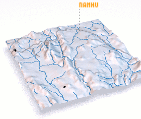 Places with similar names to Namhū, Myanmar ::
Disclaimer :: Information on this page comes without warranty of any kind |
||
|
Where is Namhū? Elevation and coordinates ::
Latitude (lat): 20°57'0"N Longitude (lon): 97°46'0"E
Elevation (approx.): 967m (map arrows pan, magnifying glasses zoom) |
||
|
Visiting Namhū? Hotel/Accommodation ::
Book a hotel in Namhū Travel Guide ::
Buy a travel guide for Myanmar rental cars ::
car rental offers GPS waypoint ::
download a GPX waypoint (PoI) of Namhū for your GPS receiver
|
||