|
search place name
|
||
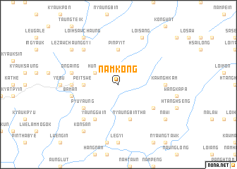
Namkong (Sagaing, Myanmar)Namkong is a town in the Sagaing region of Myanmar. An overview map of the region around Namkong is displayed below.
regional and 3d topo map of Namkong, Myanmar ::
Namkong airports ::
The nearest airport is LSH - Lashio, located 121.8 km east of Namkong.
Other airports nearby include MDL - Mandalay Intl (147.5 km south west), Nearby towns ::
Huna (3.9km north west) //
Peitswe (5.1km west) //
Pinpyit (5.6km north) //
Nyaungbintha (5.8km south) //
Höwit (6.3km south east) //
Pyu-yaung (6.3km south west) //
Yaunggwin (6.5km south west) //
Kawnghkam (6.8km east) //
Mogok (6.8km west) //
Ongaing (7.1km west) //
Baman (7.1km west) //
Myintada (7.1km west) //
Tada-u (7.6km north west) //
Panpau (7.6km south west) //
Loikalom (8.2km north east) //
Loisang (8.2km north east) //
Loihsawchaung (9.0km north west) //
Nawi (8.8km south east) //
Konsan (9.0km south west) //
Lezawchaunggyi (8.8km north west) //
Palaungchaunggyi (8.8km north west) //
[all distances 'as the bird flies' and approximate] 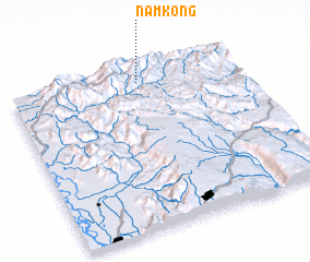 Places with similar names to Namkong, Myanmar ::
// Nam-keng (MM)
// Nam Kong (MM)
// Nam-kong (MM)
// Namkong (MM)
// Nammawkēng (MM)
// Namme-kong (MM)
// Noma-kang (MM)
// Nimgong (BT)
// Numba-Kungu (CD)
// Namagunga (UG)
Disclaimer :: Information on this page comes without warranty of any kind |
||
|
Where is Namkong? Elevation and coordinates ::
Latitude (lat): 22°55'0"N Longitude (lon): 96°34'0"E
Elevation (approx.): 1275m (map arrows pan, magnifying glasses zoom) |
||
|
Visiting Namkong? Hotel/Accommodation ::
Book a hotel in Namkong Travel Guide ::
Buy a travel guide for Myanmar rental cars ::
car rental offers GPS waypoint ::
download a GPX waypoint (PoI) of Namkong for your GPS receiver
|
||