|
search place name
|
||
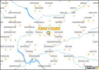
Namkyinwan (Shan, Myanmar)Namkyinwan is a town in the Shan region of Myanmar. An overview map of the region around Namkyinwan is displayed below.
regional and 3d topo map of Namkyinwan, Myanmar ::
Namkyinwan airports ::
The nearest airport is LSH - Lashio, located 87.3 km west of Namkyinwan.
Other airports nearby include KET - Kengtung (221.1 km south east), Nearby towns ::
Namhpük (0.0km north) //
Loi-vinghkam (1.7km west) //
Pang-yok (1.7km east) //
Pangnawt (2.5km north east) //
Pangla (3.4km west) //
Namheng (3.7km north) //
Ho-yawng (3.4km east) //
Hpakkum (4.1km south west) //
Kawng Mān Möng (4.1km south east) //
Mān Tun (3.9km south east) //
Hsopmong (5.0km north west) //
Na-pong (5.0km north east) //
Namtwei (5.6km north) //
Mān Nampe (5.6km south) //
Mān La (5.4km east) //
Namkangloi (6.3km south west) //
Möng Hko (6.5km north east) //
Panghkang (6.5km north east) //
Mān Tong (7.4km south) //
Makhpa (6.8km west) //
Mān Kawnghsung (7.1km west) //
Mān Namwai (7.1km west) //
Panghung (7.6km south west) //
Mān Lok (7.6km south east) //
Mān Na (7.6km north east) //
Mān Kawngning (7.8km north west) //
Pangwo (7.8km south west) //
Mān Mom (8.8km south east) //
Mān Lao (9.0km north east) //
[all distances 'as the bird flies' and approximate] 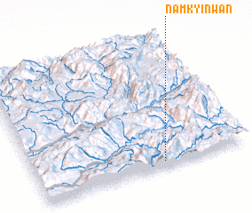 Places with similar names to Namkyinwan, Myanmar :: Disclaimer :: Information on this page comes without warranty of any kind |
||
|
Where is Namkyinwan? Elevation and coordinates ::
Latitude (lat): 23°3'0"N Longitude (lon): 98°36'0"E
Elevation (approx.): 1722m (map arrows pan, magnifying glasses zoom) |
||
|
Visiting Namkyinwan? Hotel/Accommodation ::
Book a hotel in Namkyinwan Travel Guide ::
Buy a travel guide for Myanmar rental cars ::
car rental offers GPS waypoint ::
download a GPX waypoint (PoI) of Namkyinwan for your GPS receiver
|
||