|
search place name
|
||
Nampangmöng (Shan, Myanmar)Nampangmöng is a town in the Shan region of Myanmar. An overview map of the region around Nampangmöng is displayed below.
regional and 3d topo map of Nampangmöng, Myanmar ::

Nampangmöng airports ::
The nearest airport is LSH - Lashio, located 144.2 km north of Nampangmöng.
Other airports nearby include HEH - Heho (154.8 km south west), KET - Kengtung (184.8 km east), MOG - Mong Hsat (191.2 km south east), MDL - Mandalay Intl (198.9 km west), Nearby towns ::
Loi-hun (1.9km north) //
Namlin (2.5km south east) //
Nā-hkam (2.5km south west) //
Nam-maw-hsai (3.4km east) //
Mān Sam (3.4km west) //
Namtin (3.9km north east) //
Wān Kyawng (4.1km south east) //
Konghke (5.2km east) //
Wān Nā (5.5km east) //
Namkwai (5.8km north) //
Nawngleng (5.8km south) //
Wān Hkum (5.8km south) //
Mak-hpīt (5.5km west) //
Ho-löng (6.5km north west) //
Wān Et (6.4km north east) //
Hwè-wa (6.4km north west) //
Kongnang (7.4km south) //
Wān Loi-yè (7.6km north east) //
Nā-pong (7.6km north west) //
Linlum (7.8km south west) //
Wān Ponghawng (7.8km north east) //
Hwè-hok (9.0km south west) //
Wān Hkokhi (10.1km south east) //
[all distances 'as the bird flies' and approximate] 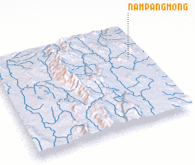 Places with similar names to Nampangmöng, Myanmar :: Disclaimer :: Information on this page comes without warranty of any kind |
||
|
Where is Nampangmöng? Elevation and coordinates ::
Latitude (lat): 21°41'0"N Longitude (lon): 97°54'0"E
Elevation (approx.): 1440m (map arrows pan, magnifying glasses zoom) |
||
|
Visiting Nampangmöng? Hotel/Accommodation ::
Book a hotel in Nampangmöng Travel Guide ::
Buy a travel guide for Myanmar rental cars ::
car rental offers GPS waypoint ::
download a GPX waypoint (PoI) of Nampangmöng for your GPS receiver
|
||