|
search place name
|
||
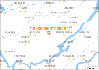
'Nhkang Kayang Ga (Kachin State, Myanmar)'Nhkang Kayang Ga is a town in the Kachin State region of Myanmar. An overview map of the region around 'Nhkang Kayang Ga is displayed below.
regional and 3d topo map of 'Nhkang Kayang Ga, Myanmar ::
'Nhkang Kayang Ga airports ::
The nearest airport is PBU - Putao, located 115.0 km north east of 'Nhkang Kayang Ga.
Other airports nearby include MYT - Myitkyina (143.9 km south east), MOH - Mohanbari Dibrugarh (196.1 km north west), Nearby towns ::
'Nzang Ga (2.5km north west) //
Chenam Ga (3.8km north west) //
Janhtang Ga (5.0km west) //
'Mba Tingkrang Ga (5.0km east) //
Tumhpang Ga (5.3km west) //
Lakawng Ga (5.3km west) //
Lanem Ga (6.2km north east) //
Sinlung Ga (6.6km west) //
'Ndawng Ga (7.6km north) //
'Nnaw Ga (6.9km east) //
'Nding Ga (7.6km north) //
Sina Gahtawng (7.5km south east) //
Shipreng (7.6km south east) //
Watat Ga (8.1km north west) //
Warang Ga (8.7km north west) //
'Nchaw Ga (8.9km north east) //
'Nchaw Ga (8.9km north west) //
[all distances 'as the bird flies' and approximate] 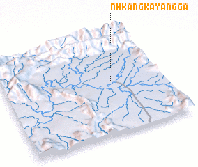 Places with similar names to 'Nhkang Kayang Ga, Myanmar :: Disclaimer :: Information on this page comes without warranty of any kind |
||
|
Where is 'Nhkang Kayang Ga? Elevation and coordinates ::
Latitude (lat): 26°32'0"N Longitude (lon): 96°41'0"E
Elevation (approx.): 231m (map arrows pan, magnifying glasses zoom) |
||
|
Visiting 'Nhkang Kayang Ga? Hotel/Accommodation ::
Book a hotel in 'Nhkang Kayang Ga Travel Guide ::
Buy a travel guide for Myanmar rental cars ::
car rental offers GPS waypoint ::
download a GPX waypoint (PoI) of 'Nhkang Kayang Ga for your GPS receiver
|
||