|
search place name
|
||
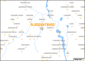
Nlongahtawng (Kachin State, Myanmar)Nlongahtawng is a town in the Kachin State region of Myanmar. An overview map of the region around Nlongahtawng is displayed below.
regional and 3d topo map of Nlongahtawng, Myanmar ::
Nlongahtawng airports ::
The nearest airport is MYT - Myitkyina, located 66.2 km east of Nlongahtawng.
Other airports nearby include PBU - Putao (218.8 km north), Nearby towns ::
Kadawkawng (2.5km north west) //
'Nhkum (3.3km east) //
Hpaotut (3.3km east) //
Paochu (3.7km north) //
Lakatkawng (3.8km north east) //
Yekan (3.8km north east) //
Hpaojegahtawng (5.0km south west) //
Sabyigahtawng (5.4km west) //
Pwelaw (6.5km north east) //
Kamaing (6.5km north east) //
Takho (6.2km north west) //
Chinmong (6.2km south west) //
Seton (6.9km east) //
Chakrao (7.5km north west) //
Zigyun (8.1km north east) //
'Ntapgahtawng (8.7km south east) //
Hkachang (10.0km south west) //
Chikchigahtawng (10.0km south east) //
[all distances 'as the bird flies' and approximate] 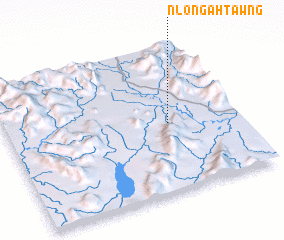 Places with similar names to Nlongahtawng, Myanmar ::
// Nallang-dong (KP)
// Nalincaidang (CN)
Disclaimer :: Information on this page comes without warranty of any kind |
||
|
Where is Nlongahtawng? Elevation and coordinates ::
Latitude (lat): 25°28'0"N Longitude (lon): 96°42'0"E
Elevation (approx.): 482m (map arrows pan, magnifying glasses zoom) |
||
|
Visiting Nlongahtawng? Hotel/Accommodation ::
Book a hotel in Nlongahtawng Travel Guide ::
Buy a travel guide for Myanmar rental cars ::
car rental offers GPS waypoint ::
download a GPX waypoint (PoI) of Nlongahtawng for your GPS receiver
|
||