|
search place name
|
||
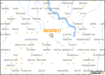
Oksingyi (Sagaing, Myanmar)Oksingyi is a town in the Sagaing region of Myanmar. An overview map of the region around Oksingyi is displayed below.
regional and 3d topo map of Oksingyi, Myanmar ::
Oksingyi airports ::
The nearest airport is MDL - Mandalay Intl, located 97.3 km south east of Oksingyi.
Other airports nearby include HEH - Heho (232.2 km south east), Nearby towns ::
Pokkon (2.5km south west) //
Shaukka (2.5km south east) //
Kaungthit (2.5km north east) //
Kyundaw (4.1km south west) //
Neyagin (3.9km south west) //
Kaingywa (3.9km south west) //
Uyintha (5.1km east) //
Poktadaw (5.8km north) //
Shagon (5.8km south) //
Aungtha (5.5km east) //
Hintha (5.5km west) //
Ywatha (5.8km south) //
Nyaungbintha (6.3km north east) //
Lethlok (6.5km north east) //
Yathit (6.5km north east) //
Mugan (7.4km north) //
Kontha (7.4km north) //
Kyungyaung (7.1km west) //
Leinhla (7.1km west) //
Thitseingyi (7.1km east) //
Baunggya (7.6km south east) //
Teikywa (7.6km north west) //
Okkan (7.8km south west) //
Myinthi (7.8km south east) //
Payahmi (8.8km south west) //
Tugyi (9.0km north east) //
Tèbin (9.0km north east) //
Kyabinhla (9.0km south west) //
Wayongan (8.8km north east) //
[all distances 'as the bird flies' and approximate] 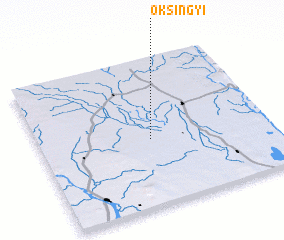 Places with similar names to Oksingyi, Myanmar :: Disclaimer :: Information on this page comes without warranty of any kind |
||
|
Where is Oksingyi? Elevation and coordinates ::
Latitude (lat): 22°27'0"N Longitude (lon): 95°29'0"E
Elevation (approx.): 88m (map arrows pan, magnifying glasses zoom) |
||
|
Visiting Oksingyi? Hotel/Accommodation ::
Book a hotel in Oksingyi Travel Guide ::
Buy a travel guide for Myanmar rental cars ::
car rental offers GPS waypoint ::
download a GPX waypoint (PoI) of Oksingyi for your GPS receiver
|
||