|
search place name
|
||
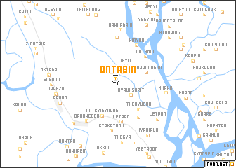
Ontabin (Mon State, Myanmar)Ontabin is a town in the Mon State region of Myanmar. An overview map of the region around Ontabin is displayed below.
regional and 3d topo map of Ontabin, Myanmar ::
Ontabin airports ::
The nearest airport is RGN - Yangon Intl, located 152.9 km west of Ontabin.
Other airports nearby include LPT - Lampang (274.9 km north east), Nearby towns ::
Tanbin (1.9km north east) //
Sinywa (2.0km north west) //
Kyauksarit (2.7km south east) //
I-byit (3.2km north east) //
Sanpannagon (4.7km east) //
Thebyugon (5.2km south east) //
Natkyigyaung (5.6km south west) //
Letpan (6.1km south) //
Nathmaw (6.1km north east) //
Kawpamagon (6.3km south east) //
Kinywa (6.8km north east) //
Kyonwa (7.4km north) //
Kyakatngu (7.6km south) //
Banbwegon (7.6km south west) //
Hmawbi (7.6km east) //
Letpan (8.3km south east) //
Kawkadaik (8.6km north) //
Mutkyi (9.3km south west) //
Kyaikpun (9.5km south east) //
Htun-aing (10.8km north east) //
[all distances 'as the bird flies' and approximate] 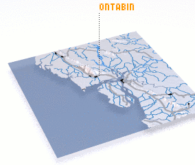
Disclaimer :: Information on this page comes without warranty of any kind |
||
|
Where is Ontabin? Elevation and coordinates ::
Latitude (lat): 16°39'3"N Longitude (lon): 97°32'33"E
Elevation (approx.): 18m (map arrows pan, magnifying glasses zoom) |
||
|
Visiting Ontabin? Hotel/Accommodation ::
Book a hotel in Ontabin Travel Guide ::
Buy a travel guide for Myanmar rental cars ::
car rental offers GPS waypoint ::
download a GPX waypoint (PoI) of Ontabin for your GPS receiver
|
||