|
search place name
|
||
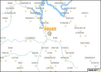
Padan (Myanmar)Padan is a town in Myanmar. An overview map of the region around Padan is displayed below.
regional and 3d topo map of Padan, Myanmar ::
Padan airports ::
The nearest airport is KYP - Kyaukpyu, located 123.0 km south west of Padan.
Other airports nearby include SNW - Thandwe (170.6 km south), AKY - Sittwe (176.2 km west), MDL - Mandalay Intl (241.5 km north east), Nearby towns ::
Sittaw (1.7km west) //
Inbo (2.5km south east) //
Myitpya (2.5km south west) //
Paukyingon (2.5km north west) //
Yinshe (3.9km south east) //
Kontha (4.1km north west) //
Sinchidaing (4.1km north west) //
Padein (5.1km north west) //
Ngahlaingdaw (5.8km north) //
Kanywa (5.8km south) //
Datkon (5.8km south) //
Thibaw (6.6km north west) //
Singon (6.6km north west) //
Nyaungbintha (6.6km north west) //
Kyaukset (6.4km north east) //
Kya-o (7.4km south) //
Lethagôn (7.2km west) //
Myebyu (7.6km south east) //
Zinbyun (8.2km south west) //
Manzon (8.2km north west) //
Kokwa (9.1km south west) //
Padaung (9.1km north east) //
Ngaleik (8.9km north east) //
Paunggyi (8.9km north west) //
Paungywa (9.1km north west) //
Mayogan (10.2km south east) //
[all distances 'as the bird flies' and approximate] 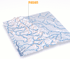 Places with similar names to Padan, Myanmar ::
Disclaimer :: Information on this page comes without warranty of any kind |
||
|
Where is Padan? Elevation and coordinates ::
Latitude (lat): 19°59'0"N Longitude (lon): 94°33'0"E
Elevation (approx.): 156m (map arrows pan, magnifying glasses zoom) |
||
|
Visiting Padan? Hotel/Accommodation ::
Book a hotel in Padan Travel Guide ::
Buy a travel guide for Myanmar rental cars ::
car rental offers GPS waypoint ::
download a GPX waypoint (PoI) of Padan for your GPS receiver
|
||