|
search place name
|
||
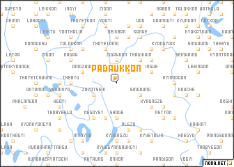
Padaukkon (Ayeyarwady, Myanmar)Padaukkon is a town in the Ayeyarwady region of Myanmar. An overview map of the region around Padaukkon is displayed below.
regional and 3d topo map of Padaukkon, Myanmar ::
Padaukkon airports ::
The nearest airport is RGN - Yangon Intl, located 102.4 km south east of Padaukkon.
Other airports nearby include SNW - Thandwe (157.7 km north west), KYP - Kyaukpyu (290.7 km north west), Nearby towns ::
Pauktangyi (2.6km north east) //
Zidawgon (3.7km north) //
Pauktangale (3.7km north) //
Singaung (4.0km south east) //
Zayatseik (4.0km south west) //
Thadikwin (5.1km north east) //
Shage (5.6km south) //
Ingwe (5.6km east) //
Aingzauk (5.6km west) //
Migyaung-u (5.6km west) //
Mezalidaw (5.8km north) //
Thayet-aing (5.8km north) //
Nemaneik (5.8km south) //
Suttaya (6.5km north east) //
Megayet (6.6km south west) //
Kyaungzu (6.5km south east) //
Neikban (7.4km north) //
Thebyu (7.1km west) //
Tada-u (7.6km north) //
Alezu (7.6km south) //
Pyindaunggwin (7.7km north west) //
Sinlu (7.7km north east) //
Mogok (8.2km north east) //
Kanwe (8.2km north east) //
Tinngokzu (8.0km south east) //
Madaw (8.0km north west) //
Seikkyi (8.2km south east) //
Kyongyaik (9.0km north east) //
Pettan (9.0km south east) //
[all distances 'as the bird flies' and approximate]  Places with similar names to Padaukkon, Myanmar ::
Disclaimer :: Information on this page comes without warranty of any kind |
||
|
Where is Padaukkon? Elevation and coordinates ::
Latitude (lat): 17°28'0"N Longitude (lon): 95°22'0"E
Elevation (approx.): 11m (map arrows pan, magnifying glasses zoom) |
||
|
Visiting Padaukkon? Hotel/Accommodation ::
Book a hotel in Padaukkon Travel Guide ::
Buy a travel guide for Myanmar rental cars ::
car rental offers GPS waypoint ::
download a GPX waypoint (PoI) of Padaukkon for your GPS receiver
|
||